Near Richmond in Chesterfield County, Virginia — The American South (Mid-Atlantic)
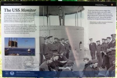
The USS Monitor
Contrary to some reports, the Monitor, despite its squat turret, did not have difficulty bringing its guns to bear. Commanded by Lt. William N. Jeffers, it fired steadily against Fort Drewry. The Confederate cannon, after bouncing a few ineffective rounds off the ironclad, turned their focus to the vulnerable USS Galena. This proved to be the Monitor’s last major action.
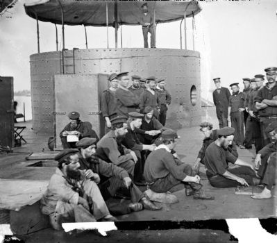
The Monitor went down on December 31, 1862, sunk in an Atlantic gale off the coast of Cape Hatteras, North Carolina. Sixteen crewmen died, perhaps including some of the men who posed in the black and white photograph taken in July 1862. In 1975, the wreck became the nation’s first National Marine Sanctuary, administered by the National Oceanic and Atmospheric Administration (NOAA). The turret of the warship emerged from the waves in August 2002, raised by NOAA and the United States Navy. It is on display at the USS Monitor Center at The Mariners Museum in Newport News, Virginia.
“It was one of those warm, muggy days…which, shut up closely as we were, made ventilation very difficult. At times we were filled with powder smoke below threatening suffocation to us all. Some of the hardiest looking men dropped fainting at the guns.”
William Keeler, an officer aboard the USS Monitor during the Battle of Drewry’s Bluff.
Erected 2012 by Richmond National Battlefield Park, National Oceanic and Atmospheric Administration.
Topics. This historical marker is listed in these topic lists: Forts and Castles • War, US Civil • Waterways & Vessels. A significant historical month for this entry is March 1846.
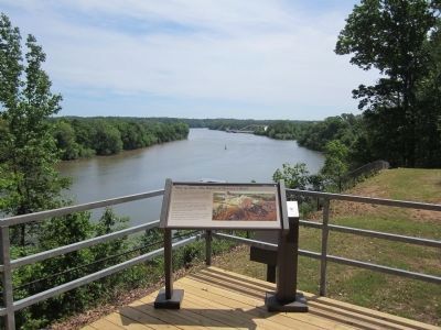
Location. 37° 25.33′ N, 77° 25.305′ W. Marker is near Richmond, Virginia, in Chesterfield County. Marker can be reached from Fort Darling Road, half a mile north of Bellwood Road. This marker is located in the Drewry’s Bluff (Fort Darling) unit of Richmond National Battlefield Park. Touch for map. Marker is at or near this postal address: 7600 Fort Darling Road, Richmond VA 23237, United States of America. Touch for directions.
Other nearby markers. At least 8 other markers are within walking distance of this marker. Drewry’s Bluff (here, next to this marker); Duty Above and Beyond (here, next to this marker); May 15, 1862—The Battle of Drewry's Bluff (a few steps from this marker); Finishing Fort Drewry (within shouting distance of this marker); A Perfect Gibraltar (within shouting distance of this marker); Hot Shot and Wooden Ships (within shouting distance of this marker); "A Very Neat Chapel" (within shouting distance of this marker); The First Marine Medal of Honor (about 300 feet away, measured in a direct line). Touch for a list and map of all markers in Richmond.
Also see . . .
1. Drewry's Bluff. Richmond National Battlefield Park (Submitted on May 14, 2012, by Bernard Fisher of Richmond, Virginia.)
2. Drewry’s Bluff. Civil War Richmond (Submitted on May 14, 2012, by Bernard Fisher of Richmond, Virginia.)
3. USS Monitor Center. The Mariners' Museum (Submitted on May 14, 2012.)
Additional keywords. The USS Monitor
Credits. This page was last revised on November 5, 2021. It was originally submitted on May 13, 2012, by Bernard Fisher of Richmond, Virginia. This page has been viewed 818 times since then and 35 times this year. Photos: 1, 2, 3. submitted on May 13, 2012, by Bernard Fisher of Richmond, Virginia. 4, 5. submitted on May 14, 2012, by Bernard Fisher of Richmond, Virginia.


