
Near Cotopaxi in Fremont County, Colorado — The American Mountains (Southwest)
Rainbow Route
⎯⎯⎯
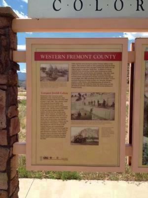
Western Fremont County
Photographed by Kevin Vincent, May 21, 2012
1. Rainbow Route / Western Fremont County Marker - Side A
[Side A:]
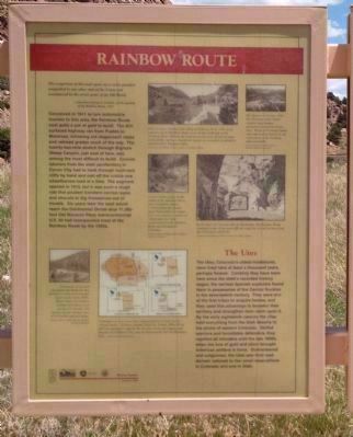
Governor George A. Carlson on the opening of the Rainbow Route, 1915
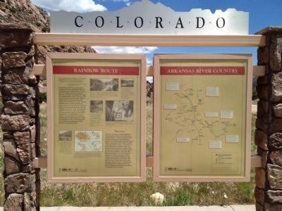
Conceived in 1911 to lure automobile tourists to this area, the Rainbow Route cost quite a pot of gold. The dirt-surfaced highway ran from Pueblo to Montrose, following old stagecoach roads and railroad grades much of the way. The twenty-two mile stretch through Bighorn Sheep Canyon, just east of here, was among the most difficult to build. Convict laborers from the state penitentiary in Canyon City had to hack through hard-rock cliffs by hand and cart off the rubble one wheelbarrow-load at a time. The segment opened in 1915, but it was such a rough ride that prudent travelers carried ropes and shovels to dig themselves out of trouble. Six years later the road would reach the Continental Divide atop the 11,386 foot Old Monarch Pass; transcontinental U.S. 50 had incorporated most of the Rainbow Route by the 1950s.
this page online
;Side B:]
Photographed by Kevin Vincent, May 21, 2012
2. Rainbow Route / Western Fremont County Marker - Side B
Photographed by Kevin Vincent
3. Rainbow Route Marker
Arkansas River Country
Erected 2001 by Colorado Historical Society. (Marker Number 269.)
Topics and series. This historical marker is listed in these topic lists: Indigenous Peoples and Communities • Roads & Vehicles. In addition, it is included in the History Colorado series list. A significant historical month for this entry is April 1882.
Location. 38° 23.43′ N, 105° 39.19′ W. Marker is near Cotopaxi, Colorado, in Fremont County. It is on U.S. 50, on the right when traveling west. Touch for map. Marker is in this post office area: Cotopaxi CO 81223, United States of America. Touch for directions.

Regionally, this marker is in Colorado’s Arkansas River Valley and in Pikes Peak Region. It is also in the American Mountain West. Globally, it is in North America, the Rocky
Photographed by Kevin Vincent, May 21, 2012
4. Marker with Background Scenery
Other nearby markers. At least 2 other markers are within 16 miles of this marker, measured as the crow flies: The Cotopaxi Jewish Agricultural Colony 1882-1884 (approx. 2.3 miles away); Mining and Ranching / Early Settlement / Westcliffe and Silver Cliff / Westcliffe Country (approx. 15½ miles away).
Also see . . .
1. Route 50 History - The Rainbow Route. At a meeting in February 1911 at the Elks' Hall in Salida, all the prominent men in road building, including the well-known Otto Mears, were reported to have been present to examine plans for a proposed "Rainbow Route" highway between Pueblo and Montrose that was to be a continuation of the old Santa F� Trail. (Submitted on May 26, 2012.)
2. The Cotopaxi Colony. An essay by Flora Jane Satt detailing the history of the Colony. (Submitted on May 26, 2012.)
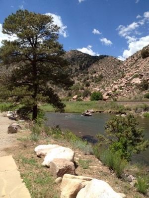
Photographed by Kevin Vincent, May 21, 2012
5. View of the Arkansas River Adjacent to Marker
Credits. This page was last revised on June 16, 2016. It was originally submitted on May 24, 2012, by Kevin Vincent of Arlington, Virginia. This page has been viewed 1,443 times since then and 56 times this year. Photos: 1, 2, 3, 4, 5. submitted on May 24, 2012, by Kevin Vincent of Arlington, Virginia. • Syd Whittle was the editor who published this page.
