Near Mount Morris in Livingston County, New York — The American Northeast (Mid-Atlantic)
The Genesee Valley
Historic New York
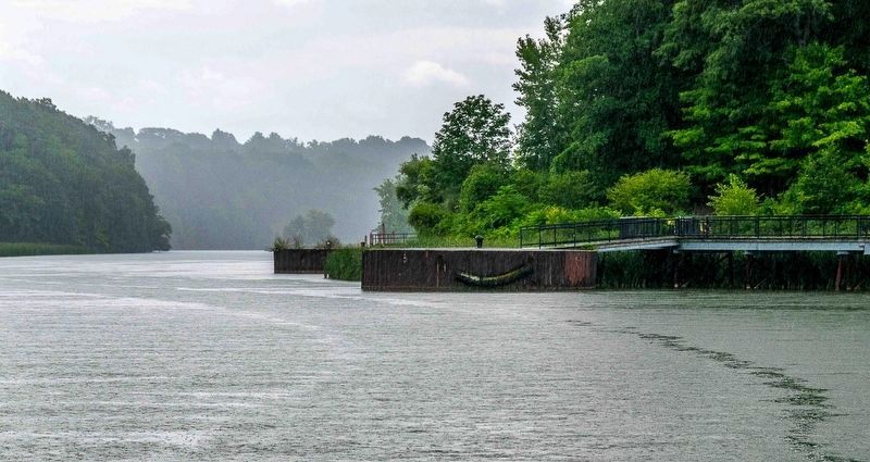
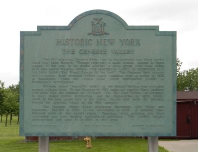
The 150 mile-long Genesee River rises in Pennsylvania and flows northward into Lake Ontario. Though relatively a small stream, except in flood stages, it has cut, in its middle portion, a deep gorge with walls rising 600 feet above foaming waters. This spectacular section in Letchworth Park has been called “The Grand Canyon of the East.” The Genesee then courses into a broad, level intervale before again tumbling over a series of falls at Rochester. There the river’s water contributed greatly to Rochester’s development.
Genesee meant “beautiful valley” to the Seneca Indians who occupied several villages here. To the Genesee in 1782 came the captive Mary Jemison who lived with the Senecas for 71 years. The Big Tree Treaty at Geneseo, in 1797, ended Indian occupation, and the Wadsworths by 1835 bought much of the best arable land in the valley. Fertile land made the Genesee famous for growing wheat in the 19th century.
The Genesee Valley Canal connected Rochester with Olean and Dansville. Started in 1836, it was abandoned in 1878. A railroad later followed much of the canal’s route. Dairying, corn growing and fruit cultivation are now leading agricultural activities. The world’s largest underground salt mine is located in the area.
Erected 1961 by State of New York Education Department & Department of Public Works.
Topics and series. This historical marker is listed in these topic lists: Agriculture • Native Americans • Settlements & Settlers • Waterways & Vessels. In addition, it is included in the Historic New York State series list. A significant historical year for this entry is 1782.
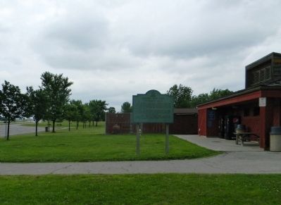
Location. 42° 43.658′ N, 77° 49.757′ W. Marker is near Mount Morris, New York, in Livingston County. Marker can be reached from Genesee Expressway (Interstate 390 at milepost 38), 4.7 miles north of Sonyea Road (New York State Route 36). The marker is located at the northbound rest area (at mile marker 38) on the Genesee Expressway. It is situated at the southwest corner of the rest room facility building. Touch for map. Marker is in this post office area: Mount Morris NY 14510, United States of America. Touch for directions.
Other nearby markers. At least 8 other markers are within 3 miles of this marker, measured as the crow flies. Williamsburgh (approx. 1.4 miles away); Williamsburg (approx. 1.4 miles away); This Park Dedicated to the Men of 3rd U.S. Marines (approx. 2.1 miles away); In Honor of the Mount Morris Veterans (approx. 2.1 miles away); Birthplace of Francis Bellamy (approx. 2.2 miles away); Burke's Tavern (approx. 2.2 miles away); Genesee Valley Greenway (approx. 2.2 miles away); Francis Bellamy Memorial Park (approx. 2.4 miles away). Touch for a list and map of all markers in Mount Morris.
Related markers. Click here for a list of markers that are related to this marker. To better understand the relationship, study the markers shown.
Also see . . .
1. The Genesee Region. Geography of New York State website entry (Submitted on June 27, 2012, by PaulwC3 of Northern, Virginia.)
2. Letchworth State Park. NYS Parks, Recreation & Historic Preservation website entry:
Letchworth State Park, renowned as the "Grand Canyon of the East," is one of the most scenically magnificent areas in the eastern U.S. (Submitted on June 27, 2012, by PaulwC3 of Northern, Virginia.)

via Genessee River Watch, unknown
3. Genesee River Basin Watershed
Genesee River Watch website entry
Click for more information.
Click for more information.
Credits. This page was last revised on February 25, 2022. It was originally submitted on June 27, 2012, by PaulwC3 of Northern, Virginia. This page has been viewed 584 times since then and 16 times this year. Photos: 1, 2. submitted on June 27, 2012, by PaulwC3 of Northern, Virginia. 3. submitted on February 25, 2022, by Larry Gertner of New York, New York.

