Plymouth in Washington County, North Carolina — The American South (South Atlantic)
CSS Albemarle
Ironclad Gunboat
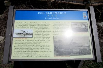
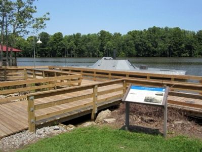
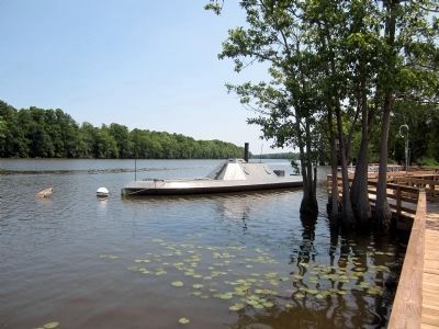
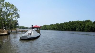
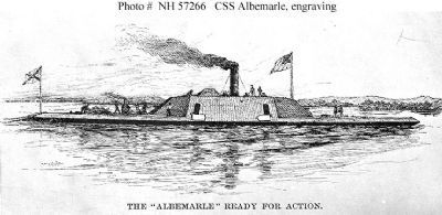
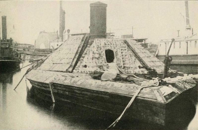
In 1863, 19-year-old engineer Gilbert Elliott contracted with the Confederate Navy Department to construct an ironclad gunboat designed by John L. Porter, the navy’s chief architect. Elliott built the vessel at Edwards Ferry on the Roanoke River, 60 miles upstream from here, where his “shipyard” was Peter E. Smith’s cornfield. It took more than a year to construct CSS Albemarle, which was 158 feet long, 35 feet wide, and topped with a 60-foot-long case-mate sheathed with two layers of two-inch-thick iron plates. Inside the casemate, two large Brooke Rifle cannons could fire hundred-pound shells. An 18-foot-long white-oak ram, also sheathed with iron plates, extended from Albemarle’s bow to puncture the sides of wooden vessels and sink them.
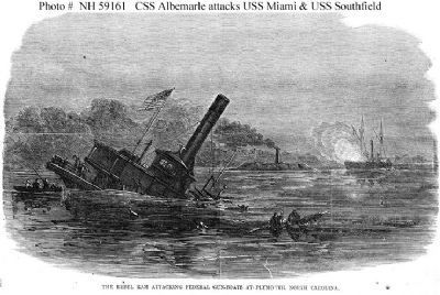
Albemarle first saw action on April 19, 1864, during the Battle of Plymouth, when it rammed and sank USS Southfield. It also indirectly caused the death of the Federal fleet’s commander, Charles W. Flusser. A shell fired from Flusser’s ship (USS Miami) at Albemarle bounced off the iron plating back onto Miami and exploded, killing Flusser, who was standing next to the cannon that had fired the shell.
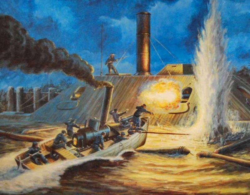
On May 5, in an engagement in Albemarle Sound, the Albemarle faced seven U.S. gunboats. Despite being outgunned 60 cannons to two, outshelled 557 to 27, and rammed, Albemarle escaped destruction. The ironclad finally was torpedoed (blown up with a mine on the end of a wooden spar) on October 27, by a motor launch commanded by Lt. William B. Cushing, and sank. The Federals recaptured Plymouth on October 31.
(captions)
The CSS Albemarle ready for action.
The CSS Albemarle rammed by the USS Sassacus
The CSS Albemarle sinking the USS Southfield.
Erected by North Carolina Civil War Trails.
Topics and series. This historical marker is listed in these topic lists: War, US Civil • Waterways & Vessels. In addition, it is included in the North Carolina Civil War Trails series list. A significant historical date for this entry is April 19, 1864.
Location. 35° 52.14′ N, 76° 44.895′ W. Marker is in Plymouth, North Carolina, in Washington County. Marker can be reached from the intersection of East Water Street and Madison Street, on the left when traveling east. Located behind the Port O’ Plymouth Roanoke River Museum. Touch for map. Marker is at or near this postal address: 302 E Water St, Plymouth NC 27962, United States of America. Touch for directions.
Other nearby markers. At least 8 other markers are within walking distance of this marker. A different marker also named CSS Albemarle (here, next to this marker); Battle of Plymouth (within shouting distance of this marker); Replica 6.4 inch Brooke Rifled Cannon (within shouting distance of this marker); Siege of Plymouth, NC (within shouting distance of this marker); Rt. Rev. Alfred Augustin Watson (about 400 feet away, measured in a direct line); Cushing’s Torpedo (about 500 feet away); Latham House (about 700 feet away); Washington County Courthouse (approx. 0.2 miles away). Touch for a list and map of all markers in Plymouth.
Also see . . .
1. CSS Albemarle. Wikipedia entry (Submitted on March 6, 2021, by Larry Gertner of New York, New York.)
2. The Port o’ Plymouth Museum. (Submitted on September 1, 2021.)
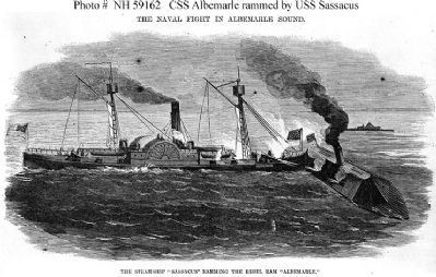
6. "The Steamship 'Sassacus' Ramming The Rebel Ram 'Albemarle'"
Engraving published in "Harper's Weekly", 4 June 1864, depicting USS Sassacus ramming CSS Albemarle, during the Confederate ironclad's engagement with U.S. Navy gunboats in Albemarle Sound, North Carolina, 5 May 1864. Naval History and Heritage Command
Credits. This page was last revised on September 1, 2021. It was originally submitted on July 1, 2012, by Bernard Fisher of Richmond, Virginia. This page has been viewed 1,014 times since then and 39 times this year. Photos: 1, 2, 3, 4, 5, 6, 7. submitted on July 1, 2012, by Bernard Fisher of Richmond, Virginia. 8, 9. submitted on March 6, 2021, by Larry Gertner of New York, New York.
