Point Harbor in Currituck County, North Carolina — The American South (South Atlantic)
Currituck Sound
Avenue of War
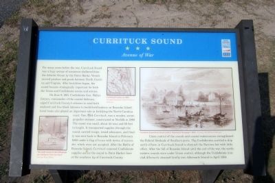
On June 9, 1861, Confederate Gen. Walter Gwynn, commander of the coastal defenses, urged Currituck County’s citizens to send both enslaved and free black laborers to build fortifications on Roanoke Island. Local boats also played an important role in fortifying the North Carolina coast. One, CSACurrituck, was a wooden, screw-propeller steamer, constructed in Norfolk in 1860. The vessel was small, about 44 tons and 60 feet in length. It transported supplies through the sound, carried troops, towed schooners, and finally was sent back to Roanoke Island in February 1862 under a flag of truce with terms of surrender, which were not accepted. After the Battle of Roanoke Island, Currituck removed Confederate supplies across the sound to Point Harbor here at the southern tip of Currituck County.
Union control of the sounds and coastal watercourses strengthened the Federal blockade of Southern ports. The Confederates scuttled a ship north of here in Currituck Sound to obstruct the Narrows but with little effect. After the fall of Roanoke Island until the end of the war, the north-eastern sounds were under Union control, although the Confederate ironclad Albemarle steamed briefly into Albemarle Sound in April 1864.
Erected by North Carolina Civil War Trails.
Topics and series. This historical marker is listed in these topic lists: War, US Civil • Waterways & Vessels. In addition, it is included in the North Carolina Civil War Trails series list. A significant historical month for this entry is February 1862.
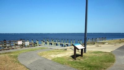
Location. 36° 5.639′ N, 75° 47.854′ W. Marker is in Point Harbor, North Carolina, in Currituck County. Marker can be reached from Kitty Hawk, half a mile east of Caratoke Highway (U.S. 158), in the median. Located in Sound Park. Touch for map. Marker is in this post office area: Point Harbor NC 27964, United States of America. Touch for directions.
Other nearby markers. At least 8 other markers are within 9 miles of this marker, measured as the crow flies. Take a Boy Fishing in North Carolina (approx. 4.6 miles away); Monument to a Century of Flight (approx. 4.6 miles away); Powder Ridge Club (approx. 5.7 miles away); Wright Brothers' Memorial (approx. 5.8 miles away); Field Research Facility (approx. 6.4 miles away); Kill Devil Hills Fire Rescue Memorial (approx. 8.3 miles away); Thomas J. Jarvis (approx. 8.6 miles away); The First Successful Flight of an Airplane (approx. 8.8 miles away).
More about this marker. On the left is an image with the caption, "The small vessels in this lithograph are similar to CSA Currituck Courtesy Tryon Palace
In the center is a map of "Currituck County, ca. 1858" Courtesy University of North Carolina Libraries
On the right is an illustration with the caption, "Currituck Sound from Frank Leslie’s Illustrated Newspaper (1859)" — Courtesy The Mariner’s Museum
Credits. This page was last revised on September 25, 2021. It was originally submitted on July 1, 2012, by Bernard Fisher of Richmond, Virginia. This page has been viewed 833 times since then and 21 times this year. Photos: 1, 2. submitted on July 1, 2012, by Bernard Fisher of Richmond, Virginia.

