Plymouth in Washington County, North Carolina — The American South (South Atlantic)
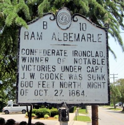
Ram Albemarle
Erected 1938 by Department of Conservation and Development. (Marker Number B-10.)
Topics and series. This historical marker is listed in these topic lists: War, US Civil • Waterways & Vessels. In addition, it is included in the North Carolina Division of Archives and History series list. A significant historical date for this entry is October 27, 1864.
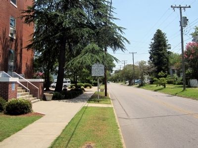
Location. This marker has been replaced by another marker nearby. It was located near 35° 52.004′ N, 76° 44.913′ W. Marker was in Plymouth, North Carolina, in Washington County. Marker was on East Main Street east of Adams Street, on the left when traveling east. Touch for map. Marker was in this post office area: Plymouth NC 27962, United States of America. Touch for directions.
Other nearby markers. At least 8 other markers are within walking distance of this location. A different marker also named Ram Albemarle (here, next to this marker); Battle of Plymouth (a few steps from this marker); Washington County North Carolina Supreme Sacrifice and Veterans Memorial (within shouting distance of this marker); Washington County Courthouse (within shouting distance of this marker); Augustin Daly (about 400 feet away, measured in a direct line); Rt. Rev. Alfred Augustin Watson (about 400 feet away); Plymouth United Methodist Church (about 500 feet away); Latham House (about 500 feet away). Touch for a list and map of all markers in Plymouth.
Related marker. Click here for another marker that is related to this marker. New Marker At This Location also titled "Ram Albemarle".
Credits. This page was last revised on June 22, 2023. It was originally submitted on July 1, 2012, by Bernard Fisher of Richmond, Virginia. This page has been viewed 604 times since then and 12 times this year. Photos: 1, 2. submitted on July 1, 2012, by Bernard Fisher of Richmond, Virginia.

