Near Roper in Washington County, North Carolina — The American South (South Atlantic)
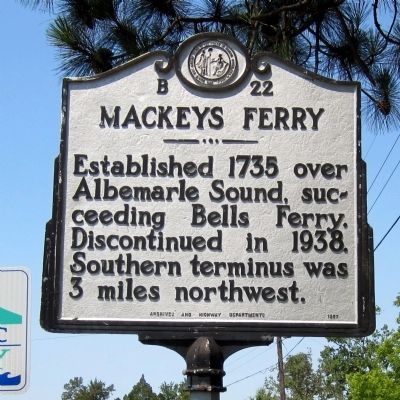
Mackeys Ferry
Erected 1957 by Archives and Highway Departments. (Marker Number B-22.)
Topics and series. This historical marker is listed in these topic lists: Colonial Era • Industry & Commerce • Waterways & Vessels. In addition, it is included in the North Carolina Division of Archives and History series list. A significant historical year for this entry is 1735.
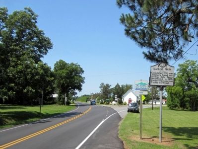
Location. 35° 55.521′ N, 76° 35.402′ W. Marker is near Roper, North Carolina, in Washington County. Marker is at the intersection of State Highway 32 and Mackeys Road (State Highway 308), on the right when traveling west on State Highway 32. Touch for map. Marker is in this post office area: Roper NC 27970, United States of America. Touch for directions.
Other nearby markers. At least 8 other markers are within 9 miles of this marker, measured as the crow flies. St. Luke's Episcopal Church (approx. 2.8 miles away); Edward Buncombe (approx. 3.8 miles away); Sleepy Hollow (approx. 3.8 miles away); Rehoboth Church (approx. 3.9 miles away); Pearidge (approx. 6.1 miles away); Edward Vail (approx. 7.7 miles away); Battle of Plymouth (approx. 8.7 miles away); Davenport Homestead (approx. 8.7 miles away). Touch for a list and map of all markers in Roper.
Credits. This page was last revised on March 17, 2024. It was originally submitted on July 1, 2012, by Bernard Fisher of Richmond, Virginia. This page has been viewed 388 times since then and 12 times this year. Photos: 1, 2. submitted on July 1, 2012, by Bernard Fisher of Richmond, Virginia.

