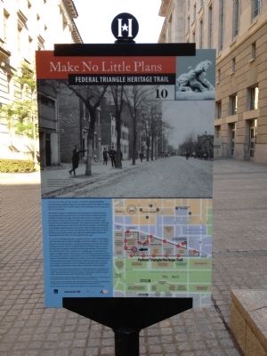
Federal Triangle in Northwest Washington in Washington, District of Columbia — The American Northeast (Mid-Atlantic)
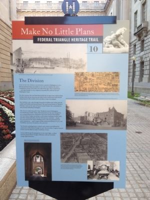
The Division
Make No Little Plans
— Federal Triangle Heritage Trail —
Soon after the Federal government moved to Washington in 1800, this area attracted shops and stables to serve the new residents. But where Constitution Avenue runs today, just south of this sign, Tiber Creek flowed - and often flooded. In 1815 engineers channeled the creek into the new Washington Canal.
By 1860, however, the canal had deteriorated into an open sewer. Impoverished families, both African American and white, lived in small wood-frame houses along unpaved, often muddy streets and alleys. Crime was rampant.
The Civil War (1861-1865) brought thousands of soldiers and civilians into the capital, and brothels and saloons thrived. This area became known as "Hooker's Division," a pun on the name of General Joseph Hooker, who commanded an Army division defending Washington.
After the war ended, Alexander "Boss" Shepherd, head of Washington's powerful Board of Public Works, filled and paved over the canal, though the area remained flood-prone. Reformers such as the Central Union Mission and Anti-Saloon League moved here, as did cabinet workshops, lumber yards, and other industrial facilities. But the old businesses continued - despite the 1908 arrival of the District Building, home to the city government and police department - until Congress finally outlawed prostitution in 1914, and Prohibition shut down the saloons a few years later.
The Division, including homes, a church, and a school, was bulldozed for construction of the Federal Triangle in 1926. Five years later, Congress renamed B Street (and the filled-in canal) Constitution Avenue.
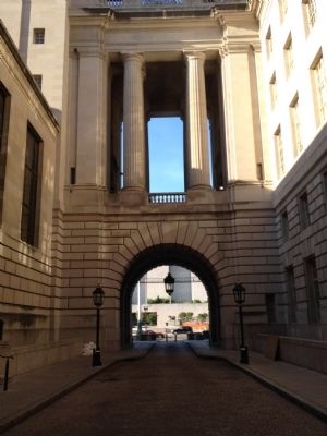
As you walk through the passageway on your way to Sign 11, please note the typical Federal Triangle cobblestone walk and rusticated (rough-edged) limestone.
Erected 2012 by Cultural Tourism DC. (Marker Number 10.)
Topics and series. This historical marker is listed in these topic lists: African Americans • Government & Politics • War, US Civil • Waterways & Vessels. In addition, it is included in the Federal Triangle Heritage Trail series list. A significant historical year for this entry is 1800.
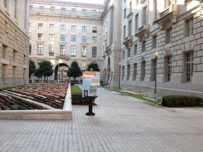
Location. 38° 53.585′ N, 77° 1.83′ W. Marker is in Northwest Washington in Washington, District of Columbia. It is in Federal Triangle. Marker can be reached from Constitution Avenue Northwest (U.S. 1/50) east of 14th Street Northwest, on the right when traveling west. Located on a walkway between the Ronald Reagan and Environmental Protection Agency Buildings. Touch for map. Marker is at or near this postal address: 1301 Constitution Avenue Northwest, Washington DC 20229, United States of America. Touch for directions.
Other nearby markers. At least 8 other markers are within walking distance of this marker. From Workers to Environment (about 300 feet away, measured in a direct line); Completing the Triangle (about 300 feet away); To the Memory of Oscar S. Straus (about 400 feet away); Keeping It Green (about 400 feet away); Arts and Artists (about 400 feet away); U. S. Post Office Department (about 400 feet away); Flags of the World (about 500 feet away); Public Art for a Modern Museum (about 500 feet away). Touch for a list and map of all markers in Northwest Washington.
Credits. This page was last revised on January 30, 2023. It was originally submitted on July 6, 2012, by Craig Swain of Leesburg, Virginia. This page has been viewed 544 times since then and 27 times this year. Photos: 1. submitted on July 6, 2012, by Craig Swain of Leesburg, Virginia. 2, 3, 4. submitted on August 12, 2012, by Craig Swain of Leesburg, Virginia.


