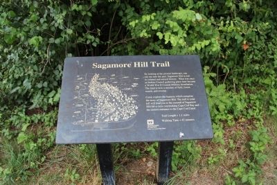
Sagamore Hill Trail
Come explore the features which comprise the story of Sagamore Hill. The trail to your left leads you to the summit of Sagamore Hill for a view of Cape Cod Bay and the Eastern section of Cape Cod Canal.
Erected by U.S. Army Corps of Engineers.
Topics. This historical marker is listed in these topic lists: Environment • Forts and Castles • Native Americans • War, World II.
Location. 41° 46.542′ N, 70° 31.066′ W. Marker is in Sandwich, Massachusetts, in Barnstable County. Marker can be reached from Scusset Beach Road, on the left when traveling east. Touch for map. Marker is in this post office area: Sagamore Beach MA 02562, United States of America. Touch for directions.
Other nearby markers. At least 8 other markers are within 2 miles of this marker, measured as the crow flies. 241st Coast Artillery (approx. 0.3 miles away); Ready Rooms (approx. 0.3 miles away); Panama Mount (approx. 0.3 miles away); Changes Through Time (approx. 0.4 miles away); Tupper Family Homestead
Also see . . . Sagamore Hill Military Reservation. (Submitted on July 8, 2012, by Bryan Simmons of Attleboro, Massachusetts.)
Credits. This page was last revised on June 16, 2016. It was originally submitted on July 8, 2012, by Bryan Simmons of Attleboro, Massachusetts. This page has been viewed 1,021 times since then and 30 times this year. Photos: 1, 2. submitted on July 8, 2012, by Bryan Simmons of Attleboro, Massachusetts. • Bill Pfingsten was the editor who published this page.

