Humboldt in Allen County, Kansas — The American Midwest (Upper Plains)
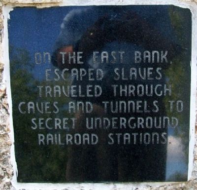
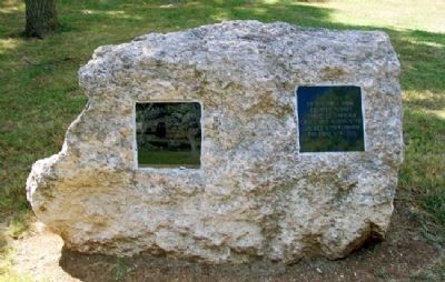
Humboldt Underground Railroad
Topics. This historical marker is listed in these topic lists: Abolition & Underground RR • African Americans • Settlements & Settlers • Waterways & Vessels.
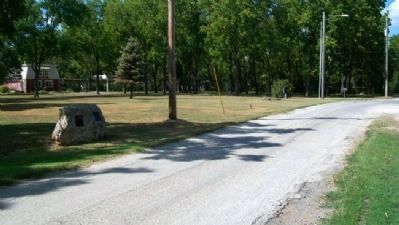
Location. 37° 48.481′ N, 95° 26.762′ W. Marker is in Humboldt, Kansas, in Allen County. Marker is on 1st Street, on the left when traveling north. Marker is about 125 feet south of Mulberry Street. Touch for map. Marker is in this post office area: Humboldt KS 66748, United States of America. Touch for directions.
Other nearby markers. At least 8 other markers are within walking distance of this marker. Aunt Polly Crosby's Cabin Site (about 600 feet away, measured in a direct line); Block House Recruiting Station (about 700 feet away); O'Brien's Mill (approx. 0.2 miles away); Neosho River Log Town (approx. 0.2 miles away); Kate Burnett (approx. half a mile away); Colonel Irvine (approx. half a mile away); Civil War Monument (approx. 0.6 miles away); Abel Secrest (approx. 0.6 miles away). Touch for a list and map of all markers in Humboldt.
Also see . . . Humboldt, Kansas. Wikipedia entry. (Submitted on November 22, 2020, by Larry Gertner of New York, New York.)
Credits. This page was last revised on November 22, 2020. It was originally submitted on July 14, 2012, by William Fischer, Jr. of Scranton, Pennsylvania. This page has been viewed 1,676 times since then and 67 times this year. Photos: 1, 2, 3, 4. submitted on July 14, 2012, by William Fischer, Jr. of Scranton, Pennsylvania.


