La Pointe in Ashland County, Wisconsin — The American Midwest (Great Lakes)
Early Vessels
Wisconsin's Maritime Trails
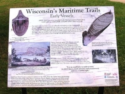
The origins of the birchbark canoe are told in the oral traditions of the Ojibwe people. The spirit Winneboujou was searching for his mother. He did not know that she had become a spirit to be with his father, the West Wind. Winneboujou was told that a large fish swallowed his mother while she was walking along Lake Superior. He walked along the shore, weeping that he could not swim far enough to search for the fish. Four trees, the White Birch, Black Spruce, White Ash, and White Cedar, heard him weeping and pitied him. They showed him how to use their wood, bark, and roots to fashion a canoe to carry him on the lake and search for his mother.
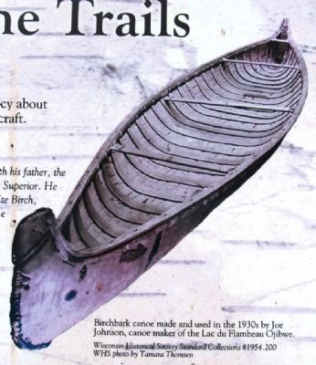
Native American canoes were efficient and well suited for traveling and gathering food along Wisconsin's lakes and rivers. Europeans quickly recognized the utility of the birchbark canoes and used them to build the Great Lakes fur trade and to explore deep into the territory that became Wisconsin. The fourteen passenger “Montreal Canoe,” which carried four tons, became common on the Great Lakes and larger rivers. Smaller canoes were used on smaller waterways.
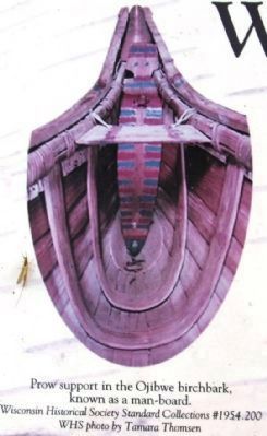
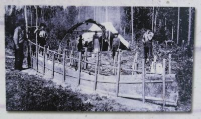
To make a canoe, a sturdy interior frame of cedar edges, ribs, and planking was constructed first. Then a birchbark covering was stitched together and attached to the frame with fibers made from spruce or pine roots. The seams were sealed with spruce or pine gum.
“It is no small labor to make a canoe, in which there is much symmetry and measurement; and it is a curious sight.” - Jacques Sabrevois de Bleury, French commandant in Detroit, 1714
Madeline Island became a center of commerce in the 1600s, when the Ojibwe began encountering traders from near and far. Other Native Americans, French, English, Americans, and Metis (people of mixed ancestry) paddled to Madeline Island from Montreal and the Straits of Mackinaw in the East and from the inland waterways of the West. The island supported a variety of Native American villages, Ojibwe burial grounds, and European and American trading posts. To this day, Madeline Island remains an important part of the cultural landscape for Wisconsin’s Native tribes.
Erected by Wisconsin Historical Society, University of Wisconsin Sea Grant Institute.
Topics and series. This historical marker is listed in these topic lists: Exploration • Native Americans • Settlements & Settlers • Waterways & Vessels. In addition, it is included in the Wisconsin’s Maritime Trails series list. A significant historical year for this entry is 1714.
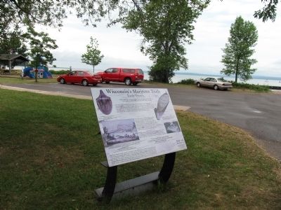
Location. 46° 46.523′ N, 90° 47.021′ W. Marker is in La Pointe, Wisconsin, in Ashland County. Marker is on Fort Road, half a mile south of Ferry Dock, on the right when traveling south. Marker is located in Memorial Park. Touch for map. Marker is in this post office area: La Pointe WI 54850, United States of America. Touch for directions.
Other nearby markers. At least 8 other markers are within 3 miles of this marker, measured as the crow flies. La Pointe Indian Cemetery (approx. ¼ mile away); Mooningwaanikaaning (approx. 0.4 miles away); Michel Cadotte (approx. 1½ miles away); A Turning Point in Place and Time (approx. 2.7 miles away); Schooner Pretoria (approx. 2.7 miles away); Memorial to Commercial Fishermen of Bayfield (approx. 2.9 miles away); The Booth Cooperage (approx. 2.9 miles away); Bayfield Historic Waterfront (approx. 2.9 miles away). Touch for a list and map of all markers in La Pointe.
Also see . . . Wisconsin's Maritime Trails. Wisconsin Historical Society (Submitted on July 26, 2012, by Bernard Fisher of Richmond, Virginia.)
Photographed By Paul Fehrenbach, June 17, 2012
4. Photo middle left
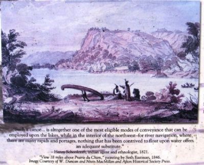
“Such a canoe… is altogether one of the most eligible modes of conveyance that can be employed upon the lakes, while in the interior of the northwest – for river navigation, where there are many rapids and portages, nothing that has been contrived to float upon water offers an adequate substitute.” - Henry Schoolcraft, Indian agent and ethnologist, 1821.
“View 18 miles above Prairie du Chien,” painting by Seth Eastman, 1846. Image courtesy of W. Duncan and Nivin MacMillan and Afton Historical Society Press.
“View 18 miles above Prairie du Chien,” painting by Seth Eastman, 1846. Image courtesy of W. Duncan and Nivin MacMillan and Afton Historical Society Press.
Credits. This page was last revised on June 16, 2016. It was originally submitted on July 25, 2012, by Paul Fehrenbach of Germantown, Wisconsin. This page has been viewed 782 times since then and 18 times this year. Photos: 1, 2, 3, 4, 5, 6. submitted on July 25, 2012, by Paul Fehrenbach of Germantown, Wisconsin. • Bernard Fisher was the editor who published this page.
