Tree Park in Chattanooga in Hamilton County, Tennessee — The American South (East South Central)
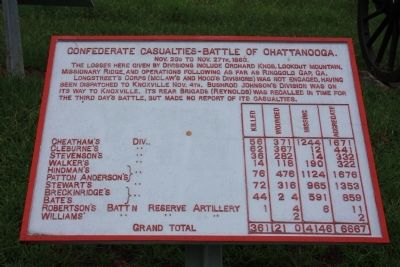
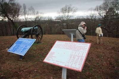
Confederate Casualties
Battle of Chattanooga
— November 23 - 27, 1863 —
Nov. 23d to Nov. 27th, 1863.
The losses here given by Divisions include Orchard Knob, Lookout Mountain, Missionary Ridge, and operations following as far as Ringgold Gap, GA.
Longstreet's Corps (McLaw's and Hood's Divisions) was not engaged, having been dispatched to Knoxville Nov. 4th. Bushrod Johnson's Division was on its way to Knoxville. Its rear Brigade (Reynolds) was recalled in time for the third day's battle, but made no report of its casualties.
Cheatham's Div. - Killed 56, Wounded 371, Missing 1244, Aggregate 1671.
Cleburne's Div. - Killed 62, Wounded 367, Missing 12, Aggregate 441.
Stevenson's Div. - Killed 36, Wounded 282, Missing 14, Aggregate 332.
Walker's Div. - Killed 14, Wounded 118, Missing 190, Aggregate 322.
Hindman's Div. and Patton Anderson's Div. - Killed 76, Wounded 476, Missing 1124, Aggregate 1676.
Stewart's Div. - Killed 72, Wounded 316, Missing 965, Aggregate 1353.
Breckinridge's Div. and Bate's Div. - Killed 44, Wounded 224, Missing 591, Aggregate 859.
Robertson's Batt'n Reserve Artillery - Killed 1, Wounded 4, Missing 6, Aggregate 11.
Williams' Batt'n Reserve Artillery - Wounded 2, Aggregate 2.
Grand Total: Killed 361, Wounded 2160, Missing 4146, Aggregate 6667.
Erected 1890 by the Chickamauga-Chattanooga National Battlefield Commission. (Marker Number MT-339D.)
Topics. This historical marker is listed in this topic list: War, US Civil. A significant historical date for this entry is November 25, 1863.
Location. 35° 4.123′ N, 85° 14.428′ W. Marker is in Chattanooga, Tennessee, in Hamilton County. It is in Tree Park. Marker can be reached from North Crest Road north of Lightfoot Mill Road. This historic marker is located in the Sherman Reservation, up on the top of the hill called "Tunnel Hill". Touch for map. Marker is in this post office area: Chattanooga TN 37406, United States of America. Touch for directions.
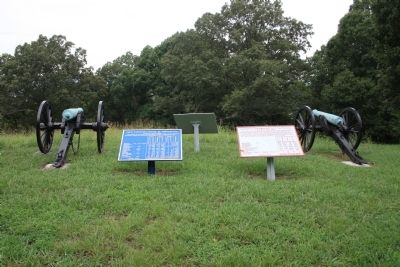
Other nearby markers. At least 8 other markers are within walking distance of this marker. Calvert's Arkansas Battery (here, next to this marker); Union Casualties (here, next to this marker); Cumming's Brigade (a few steps from this marker); Swett's Mississippi Battery (a few steps from this marker); J. A. Smith's Brigade (a few steps from this marker); Maney's Brigade (a few steps from this marker); Lewis' Brigade (a few steps from this marker); Matthies' Brigade (within shouting distance of this marker). Touch for a list and map of all markers in Chattanooga.
More about this marker. Because of its location in the Sherman Reservation it cannot be reached by car and can only be reached
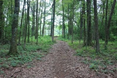
by foot. I would suggest parking your car in the provided parking area on Lightfoot Mill Road and then walking north on the Sherman Reservation footpath that begins near the corner of North Crest Road and Lightfoot Mill Road. The path goes up the slope of the hill, through a wooded area, and emerges on a hill top clearing, where the historic marker is located.
Credits. This page was last revised on February 7, 2023. It was originally submitted on July 27, 2012, by Dale K. Benington of Toledo, Ohio. This page has been viewed 610 times since then and 17 times this year. Photos: 1, 2, 3, 4. submitted on July 27, 2012, by Dale K. Benington of Toledo, Ohio. 5. submitted on December 11, 2013, by Dale K. Benington of Toledo, Ohio.
