Tree Park in Chattanooga in Hamilton County, Tennessee — The American South (East South Central)
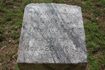
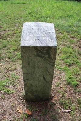
6th U.S. Missouri Infantry
U.S.A.
In Action 100 Yds. N.E.
Of This Position
Nov. 25, 1863.
Erected 1895 by the State of Missouri. (Marker Number MT-210.)
Topics and series. This historical marker is listed in this topic list: War, US Civil. In addition, it is included in the Chickamauga and Chattanooga National Military Park, Sherman Reservation, and the Chickamauga and Chattanooga National Military Park: November 25, 1863 series lists. A significant historical date for this entry is November 25, 1863.
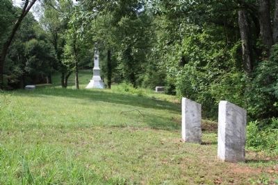
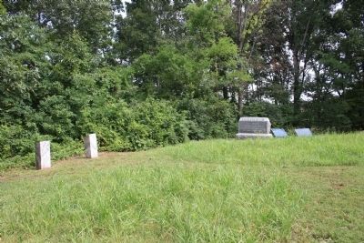
Location. 35° 4.282′ N, 85° 14.362′ W. Marker is in Chattanooga, Tennessee, in Hamilton County. It is in Tree Park. Marker is on North Crest Road north of Lightfoot Mill Road, on the right when traveling north. This historic marker is located in the Sherman Reservation, up on the hill called the "Sherman Heights," and is situated northwest of the Iowa monument. According to the location information provided by the National Park Service, “Marker is located at Sherman Reservation/1934 Map 52-45.". Touch for map. Marker is in this post office area: Chattanooga TN 37404, United States of America. Touch for directions.
Other nearby markers. At least 8 other markers are within walking distance of this marker. 55th Illinois Infantry (here, next to this marker); 8th U.S. Missouri Infantry (here, next to this marker); Army of the Tennessee (a few steps from this marker); 70th Ohio Infantry (a few steps from this marker); 53rd Ohio Infantry (a few steps from this marker); Cockerill's Brigade (within shouting distance of this marker); Earthworks (within shouting distance of this marker); Ewing's Division (within shouting distance of this marker). Touch for a list and map of all markers in Chattanooga.
More about this marker. Because of its location in the Sherman Reservation it cannot be reached by car and can only be reached by foot. I would suggest parking your car in the provided parking area on Lightfoot Mill Road and then walking north on North Crest Road. You will reach a spot on this road where there is a locked gate barring further vehicle traffic on the road, but not foot traffic. Continue to walk all the way to the end of North Crest Road. Once there you will see a pathway that goes from the end of the road to the center of the gorge that separates "Tunnel Hill" to your south and "Sherman Heights" to your north. This historic marker is to the north on "Sherman Heights."
According to the description information provided by the National Park Service, the monument is, “A simple 15" x 15" x 3' marble shaft with a slanting inscribed top marking unit's position during the battle, November 25, 1863.”
Also see . . . 6th Missouri Volunteer Infantry. This is a link to information provided by Wikipedia, the free encyclopedia. (Submitted on July 28, 2012, by Dale K. Benington of Toledo, Ohio.)
Credits. This page was last revised on February 7, 2023. It was originally submitted on July 28, 2012, by Dale K. Benington of Toledo, Ohio. This page has been viewed 480 times since then and 9 times this year. Photos: 1, 2, 3, 4, 5. submitted on July 28, 2012, by Dale K. Benington of Toledo, Ohio.


