Fort Ann in Washington County, New York — The American Northeast (Mid-Atlantic)
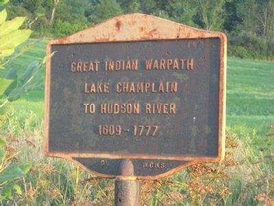
Great Indian Warpath
Erected by Washington County Historical Society.
Topics. This historical marker is listed in these topic lists: Colonial Era • Native Americans • War, French and Indian • War, US Revolutionary. A significant historical year for this entry is 1609.
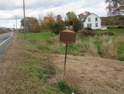
Location. 43° 21.861′ N, 73° 29.645′ W. Marker is in Fort Ann, New York, in Washington County. Marker is on New York State Route 149 close to Kingsbury Rd when traveling south. Touch for map. Marker is in this post office area: Fort Ann NY 12827, United States of America. Touch for directions.
Other nearby markers. At least 8 other markers are within 4 miles of this marker, measured as the crow flies. Smith's Basin (approx. 0.4 miles away); Kingsbury Street (approx. 1.9 miles away); Burgoyne's Army (approx. 1.9 miles away); Underground Railway Marker (approx. 2.9 miles away); Adamsville (approx. 3.2 miles away); Old Stone House Library (approx. 3.3 miles away); Fort Ann War Memorial / Henry Sartwell / Lester Archer (approx. 3.4 miles away); Fort Anne First Baptist Church (approx. 3.4 miles away). Touch for a list and map of all markers in Fort Ann.
Credits. This page was last revised on June 16, 2016. It was originally submitted on August 8, 2012, by Tom McGreevy of Averill Park, New York. This page has been viewed 895 times since then and 56 times this year. Photos: 1. submitted on August 8, 2012, by Tom McGreevy of Averill Park, New York. 2. submitted on October 16, 2015, by Bill Coughlin of Woodland Park, New Jersey. • Bill Pfingsten was the editor who published this page.

