Tree Park in Chattanooga in Hamilton County, Tennessee — The American South (East South Central)
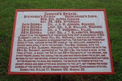
Cumming's Brigade
Stevenson's Division
— Breckinridge's Corps. —
Stevenson's Division - Breckinridge's Corps.
Brig. Gen. Alfred Cumming.
Nov. 25, 1863, Afternoon.
34th Georgia - Col. J. A. W. Johnson, Wounded.
38th Georgia - Lieut. Col. A. E. Wallace, Wounded.
39th Georgia - Col. J. T. McConnell, Killed.
56th Georgia - Lieut. Col. J. T. Slaughter, Wounded.
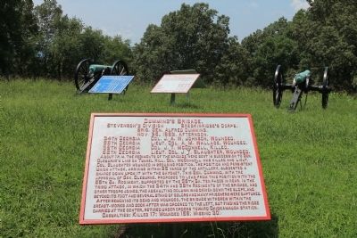
About 1 P.M. the regiments of the Brigade were sent in succession to Gen. Cleburne's line on Tunnel Hill. Col. McConnell was killed and Lieut. Col. Slaughter wounded in securing position. The position and persistent Union attack, arriving within 25 yards of the artillery, suggested a charge down upon it with the bayonet. This Gen. Cumming, with the approval of Gen. Cleburne, proposed to lead from this position with the 56th Ga. Regiment, supported by the 36th Ga. ten paces in rear. In the third attack, in which the 34th and 39th Regiments of the Brigade, and other troops joined, the assaulting column was driven down the slope, and beyond its foot and several stand of colors and many prisoners were captured.
After removing its dead and wounded, the Brigade withdrew within the breast-works and soon after was ordered to the left, but finding the ridge carried at the center, retired under orders toward Chickamauga Station.
Casualties: Killed 17; Wounded 156; Missing 30.
Erected 1890 by the Chickamauga-Chattanooga National Battlefield Commission. (Marker Number MT-369.)
Topics and series. This historical marker is listed in this topic list: War, US Civil. In addition, it is included in the Chickamauga and Chattanooga National Military Park, Sherman Reservation, and the Chickamauga and Chattanooga National Military Park: November 25, 1863 series lists. A significant historical month for this entry is October 1950.
Location. 35° 4.124′ N, 85° 14.42′ W. Marker is in Chattanooga, Tennessee, in Hamilton County. It is in Tree Park. Marker can be reached from North Crest Road north of Lightfoot Mill Road. This historic marker is located in the Sherman Reservation, up on the top of the hill called "Tunnel Hill". Touch for map. Marker is in this post office area: Chattanooga TN 37404, United States of America. Touch for directions.
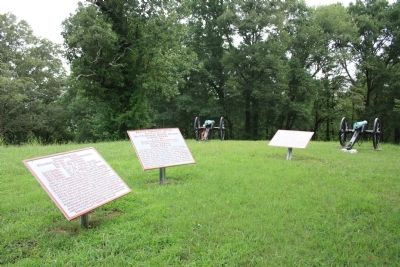
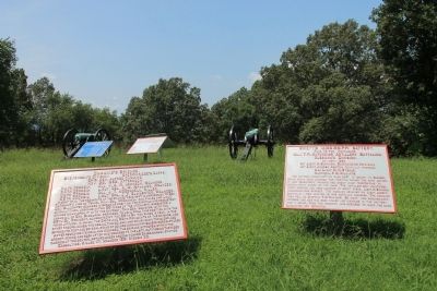
Other nearby markers. At least 8 other markers are within walking distance of this marker. Swett's Mississippi Battery (here, next to this marker); J. A. Smith's Brigade (here, next to this marker); Confederate Casualties (a few steps from this marker); Union Casualties (a few steps from this marker); Calvert's Arkansas Battery (a few steps from this marker); Maney's Brigade (a few steps from this marker); Lewis' Brigade
(a few steps from this marker); 93rd Illinois Infantry (within shouting distance of this marker). Touch for a list and map of all markers in Chattanooga.
More about this marker. Because of its location in the Sherman Reservation it cannot be reached by car and can only be reached by foot. I would suggest parking your car in the provided parking area on Lightfoot Mill Road and then walking north on the Sherman Reservation footpath that begins near the corner of North Crest Road and Lightfoot Mill Road. The path goes up the slope of the hill, through a wooded area, and emerges on a hill top clearing, where the historic marker is located.
Photographed By Brandon Fletcher, September 14, 2013
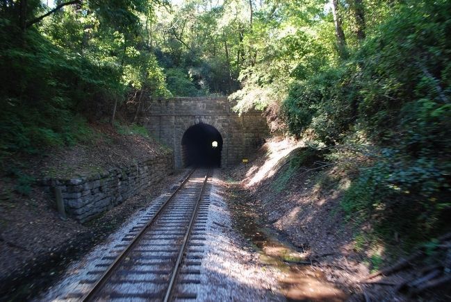
5. Tunnel Hill Railroad Tunnel, Missionary Ridge
Here at the tunnel, Cleburne held the right flank against Sherman's troops.
To reach the tunnel, purchase tickets at the Tennessee Valley Railroad Museum, take the Missionary Ridge Local or the Chickamauga Turn train tour. On the train, you can get a view of the tunnel as the train passes through it.
Website: http://www.tvrail.com/events-exhibits/
To reach the tunnel, purchase tickets at the Tennessee Valley Railroad Museum, take the Missionary Ridge Local or the Chickamauga Turn train tour. On the train, you can get a view of the tunnel as the train passes through it.
Website: http://www.tvrail.com/events-exhibits/
Photographed By Google Earth 10/22/2014
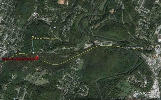
6. Route to Tunnel Hill, Missionary Ridge Map
Courtesy of Google Earth
Tennessee Valley Railroad Museum (white)
Railroad line to Tunnel Hill (yellow line)
Sherman's Reservation Carpark & Trail (white)
Sherman's Reservation Trail (blue)
Sherman's Reservation (yellow)
Tunnel Hill at Missionary Ridge (red)
Tennessee Valley Railroad Museum (white)
Railroad line to Tunnel Hill (yellow line)
Sherman's Reservation Carpark & Trail (white)
Sherman's Reservation Trail (blue)
Sherman's Reservation (yellow)
Tunnel Hill at Missionary Ridge (red)
Credits. This page was last revised on February 7, 2023. It was originally submitted on August 11, 2012, by Dale K. Benington of Toledo, Ohio. This page has been viewed 571 times since then and 38 times this year. Photos: 1, 2, 3, 4. submitted on August 11, 2012, by Dale K. Benington of Toledo, Ohio. 5, 6. submitted on September 26, 2015, by Brandon Fletcher of Chattanooga, Tennessee.
