Near Copperopolis in Calaveras County, California — The American West (Pacific Coastal)
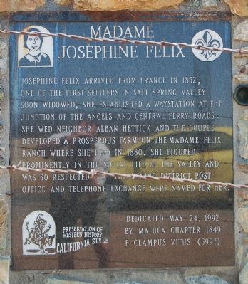
Madame Josephine Felix
Erected 1992 by E Clampus Vitus, Matuca Chapter 1849.
Topics and series. This historical marker is listed in these topic lists: Agriculture • Settlements & Settlers • Women. In addition, it is included in the E Clampus Vitus series list. A significant historical year for this entry is 1852.
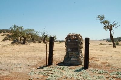
Location. 38° 1.273′ N, 120° 41.738′ W. Marker is near Copperopolis, California, in Calaveras County. Marker is on Rock Creek Road, 4.2 miles north of California Highway 4. Touch for map. Marker is in this post office area: Copperopolis CA 95228, United States of America. Touch for directions.
Other nearby markers. At least 8 other markers are within 5 miles of this marker, measured as the crow flies. Copperopolis Park (approx. 4 miles away); Black Bart at Funk Hill (approx. 4 miles away); The Copperopolis Bell and Cannon (approx. 4 miles away); Copperopolis (approx. 4.2 miles away); Congregational Church (approx. 4.2 miles away); Calaveras Telephone (approx. 4.3 miles away); a different marker also named Copperopolis (approx. 4.3 miles away); Thomas McCarty (approx. 4.3 miles away). Touch for a list and map of all markers in Copperopolis.
Credits. This page was last revised on October 23, 2019. It was originally submitted on August 29, 2012, by Barry Swackhamer of Brentwood, California. This page has been viewed 930 times since then and 24 times this year. Photos: 1, 2. submitted on August 29, 2012, by Barry Swackhamer of Brentwood, California. • Syd Whittle was the editor who published this page.

