Warrenton in Fauquier County, Virginia — The American South (Mid-Atlantic)
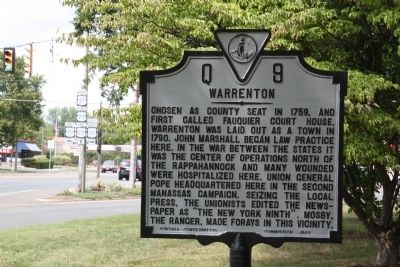
Warrenton
Erected 1948 by Virginia Conservation Commission. (Marker Number Q-9.)
Topics and series. This historical marker is listed in these topic lists: Colonial Era • War, US Civil. In addition, it is included in the Virginia Department of Historic Resources (DHR) series list. A significant historical year for this entry is 1759.
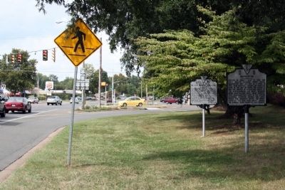
Location. 38° 43.021′ N, 77° 48.466′ W. Marker is in Warrenton, Virginia, in Fauquier County. Marker is at the intersection of West Shirley Avenue (U.S. 17) and Waterloo Street (Business U.S. 211), on the left when traveling south on West Shirley Avenue. This intersection also includes Frost Avenue (U.S. 211) and Broadview Avenue (U.S. 29 Business). It is in front of Carousel Frozen Treats, the frozen custard stand with the bright pink awning on the southeast corner of the intersection. Touch for map. Marker is at or near this postal address: 346 Waterloo St, Warrenton VA 20186, United States of America. Touch for directions.
Other nearby markers. At least 8 other markers are within walking distance of this marker. Black Horse Cavalry (here, next to this marker); Fauquier County Veterans Memorial (approx. ¼ mile away); Warrenton Cemetery Confederate Dead Monument (approx. half a mile away); Civil War Soldiers Buried in the Warrenton Cemetery (approx. half a mile away); Warrenton Cemetery (approx. half a mile away); Executions in the Yard (approx. 0.7 miles away); Old Fauquier County Jail (approx. 0.7 miles away); John Singleton Mosby (approx. 0.7 miles away). Touch for a list and map of all markers in Warrenton.
More about this marker. This marker was moved here from its original location on Culpeper Street (the current County Route 802) at the southwestern entrance to town on the western road from Culpeper via Jeffersonton. This was a primary Virginia route (State Route 29) that was demoted to a county road the same year the marker was erected.
Also see . . . General History. “According to an early account, ‘Huge wagons and vans come over the mountains from the rich counties of Orange, Culpeper, Rappahannock and Loudoun, loaded with wheat, corn and oats; the housewife sent her poultry and dried fruit; great herds of cattle wended their way to this town...For its size (604 population in 1860), Warrenton was the richest town in the whole South’.” (Submitted on September 1, 2012.)
Credits. This page was last revised on June 16, 2016. It was originally submitted on September 1, 2012, by J. J. Prats of Powell, Ohio. This page has been viewed 694 times since then and 14 times this year. Photos: 1, 2. submitted on September 1, 2012, by J. J. Prats of Powell, Ohio.

