Northshore in Chattanooga in Hamilton County, Tennessee — The American South (East South Central)
Occupied Chattanooga
The Waterfront
Photographed by Dale K. Benington, August 1, 2012
1. Occupied Chattanooga Marker
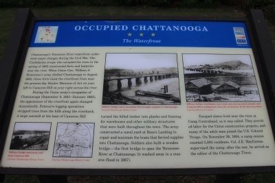
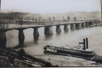
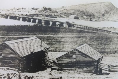
During the Union army's occupation of Chattanooga (Sept. 9, 1863 - Summer 1865), the appearance of the riverfront again changed dramatically. Extensive logging operations stripped trees from the hills along the riverbank. A large sawmill at the base of Cameron Hill turned the felled timber into planks and framing for warehouses and other military structures that were built throughout the town. The army constructed a naval yard st Ross's Landing to repair and maintain the boats that ferried supplies into Chattanooga. Soldiers also built a wooden bridge - the first to span the Tennessee River at Chattanooga (it washed away in a massive flood in 1867).
Escaped slaves lived near the river at Camp Contraband,
this page online
Erected by the Tennessee Civil War Trails.
Topics and series. This historical marker is listed in this topic list: War, US Civil. In addition, it is included in the Tennessee Civil War Trails series list. A significant historical month for this entry is November 1778.
Location. 35° 3.607′ N, 85° 18.556′ W. Marker is in Chattanooga, Tennessee, in Hamilton County. It is in Northshore. It is on River Street west of Tremont Street. This historic marker is located along the north side of the river, in a community park, along a river walking trail, almost directly below where the "John Ross Bridge" crosses the Tennessee River. Touch for map. Marker is in this post office area: Chattanooga TN 37403, United States of America. Touch for directions.

Regionally, this marker is in the American South, specifically in the Upper South, in Appalachia, and specifically
Photographed by Dale K. Benington, August 1, 2012
2. Occupied Chattanooga Marker
Close-up view of one of the pictures displayed on the marker. The caption reads, "Military bridge and a steamboat that brought supplies to Chattanooga."
Other nearby markers. At least 8 other markers are within walking distance of this marker: 1838 Cherokee Removal & Trail of Tears (a few steps from this marker); Camp Contraband (about 300 feet away, measured in a direct line); United States Colored Troops (about 300 feet away); Union Block House (about 400 feet away); 1864 Military Bridge (about 500 feet away); Chattanooga's Changing Riverfront (about 700 feet away); Electrical Power and the TVA (about 700 feet away); Market Street Bridge (approx. 0.2 miles away). Touch for a list and map of all markers in Chattanooga.
Photographed by Dale K. Benington, August 1, 2012
3. Occupied Chattanooga Marker
Close-up view of one of the pictures displayed on the marker. The caption reads, "Military bridge, warehouses, navy yard, and army-operated sawmill, with Cameron Hill in background, from the north shore of the Tennessee River."
Photographed by Dale K. Benington, August 1, 2012
4. Occupied Chattanooga Marker
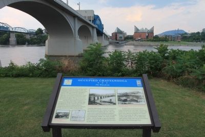
View of the historic marker on the north side of the Tennessee River, with Chattanooga in the background and the John Ross Bridge seen overhead.
Photographed by Dale K. Benington, August 1, 2012
5. Occupied Chattanooga Marker
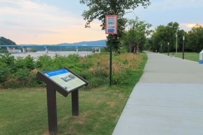
View of the historic marker looking west along the riverfront walking trail.
Photographed by Dale K. Benington, August 1, 2012
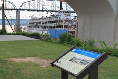
6. Occupied Chattanooga Marker
View of the historic marker looking east, with a view of the "Delta Queen" (which is currently operating as a floating boutique hotel) in the background.
Photographed by Dale K. Benington, August 1, 2012
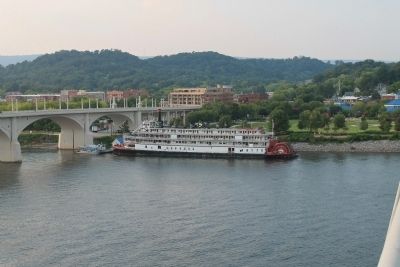
7. Occupied Chattanooga Marker
View from across the Tennessee River. The historic marker would be seen just to the left of the "John Ross Bridge," and the "Delta Queen" is seen on the right side of the bridge.
Credits. This page was last revised on February 7, 2023. It was originally submitted on September 3, 2012, by Dale K. Benington of Toledo, Ohio. This page has been viewed 1,237 times since then and 53 times this year. Photos: 1, 2, 3, 4, 5, 6, 7. submitted on September 3, 2012, by Dale K. Benington of Toledo, Ohio.
