Yorba Linda in Orange County, California — The American West (Pacific Coastal)
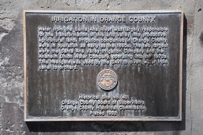
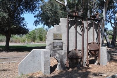
Irrigation in Orange County
Erected 1992 by Orange County Board of Supervisors and Orange County Historical Commission. (Marker Number 40.)
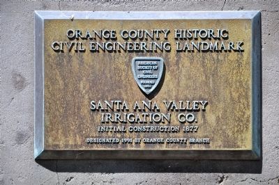
Topics and series. This historical marker is listed in these topic lists: Agriculture • Horticulture & Forestry • Industry & Commerce • Waterways & Vessels. In addition, it is included in the ASCE Civil Engineering Landmarks, and the Chinese Heritage Sites of the American West series lists.
Location. 33° 52.159′ N, 117° 42.821′ W. Marker is in Yorba Linda, California, in Orange County. Marker can be reached from Santa Ana Canyon Road. Marker is located approximately 200 feet north of the entrance to Canyon RV Park. Touch for map. Marker is at or near this postal address: 24001 Santa Ana Canyon Road, Yorba Linda CA 92887, United States of America. Touch for directions.
Other nearby markers. At least 8 other markers are within 5 miles of this marker, measured as the crow flies. The Historic Cajon Canal (approx. 0.4 miles away); Section of the Cajon Canal (approx. half a mile away); Peralta Adobe (approx. 3.4 miles away); Cañada De Los Bueyes (approx. 3½ miles away); Site of Don Bernardo Yorba Hacienda (approx. 3.8 miles away); History Speaks Softly (approx. 4 miles away); Yorba Cemetery (approx. 4 miles away); This Boulder (approx. 4.6 miles away). Touch for a list and map of all markers in Yorba Linda.
Credits. This page was last revised on August 17, 2020. It was originally submitted on September 16, 2012, by Michael Kindig of Elk Grove, California. This page has been viewed 1,042 times since then and 62 times this year. Photos: 1, 2, 3, 4. submitted on September 16, 2012, by Michael Kindig of Elk Grove, California. • Syd Whittle was the editor who published this page.


