Fountain Valley in Orange County, California — The American West (Pacific Coastal)
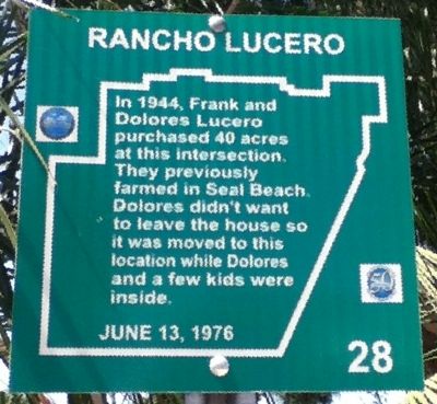
Rancho Lucero
Photographed by Greg Ullman, August 28, 2012
1. Rancho Lucero Marker
Erected 1976 by Fountain Valley Historical Society. (Marker Number 28.)
Topics. This historical marker is listed in these topic lists: Agriculture • Hispanic Americans • Settlements & Settlers. A significant historical year for this entry is 1944.
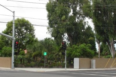
Location. 33° 42.999′ N, 117° 55.717′ W. Marker is in Fountain Valley, California, in Orange County. It is at the intersection of Warner Avenue and Newhope Street, on the right when traveling west on Warner Avenue. Touch for map. Marker is in this post office area: Fountain Valley CA 92708, United States of America. Touch for directions.

Regionally, this marker is in Greater Los Angeles and in the Peninsular Ranges. It is also on the American Pacific Coast. Globally, it is in North America, on the Ring of Fire, on the Pacific Rim, in the Western Hemisphere, in the Western World, and in the Anglosphere. Historically, it finds itself
this page online
Other nearby markers. At least 8 other markers are within 2 miles of this marker, measured as the crow flies: Thomas Hittesdorf (approx. 0.4 miles away); Colonia Jaurez (approx. one mile away); Hoffman House (approx. 1.2 miles away); Helicopter Landing Pad (approx. 1.3 miles away); Horse Ranch (approx. 1.4 miles away); Fountain Valley 9/11 Memorial (approx. 1.4 miles away); Apollo 11 (approx. 1.6 miles away); Joint Outfall System (approx. 1.6 miles away). Touch for a list and map of all markers in Fountain Valley.
Photographed by Greg Ullman, September 11, 2012
2. View of Rancho Lucero Marker
Photographed by Greg Ullman, September 11, 2012
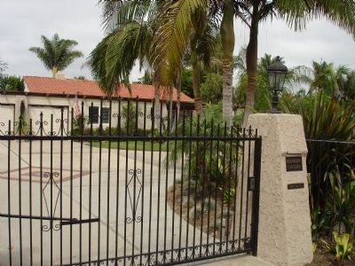
3. Rancho Lucero
A private residence, seen from outside the front gate.
Credits. This page was last revised on June 16, 2016. It was originally submitted on September 17, 2012, by Greg Ullman of Fountain Valley, California. This page has been viewed 3,799 times since then and 155 times this year. Photos: 1, 2, 3. submitted on September 17, 2012, by Greg Ullman of Fountain Valley, California. • Syd Whittle was the editor who published this page.
