Near Woodbridge in Prince William County, Virginia — The American South (Mid-Atlantic)
Preserving History
The King's Highway
A Road to Rippon Lodge
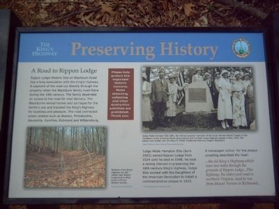
Rippon Lodge Historic Site on Blackburn road has a long association with The King’s Highway. A segment of the road cut directly through the property when the Blackburn family lived there during the 18th century. The family depended on access to the road for mail delivery. The Blackburns owned horses and carriages for the family’s use and traveled the King’s Highway for business and pleasure. The road connected urban centers such as Boston, Philadelphia, Alexandria, Dumfries, Richmond and Williamsburg.
Judge Wade Hampton Ellis (born 1865) owned Rippon Lodge from 1924 until he died in 1948. He took a strong interest in preserving the 18th-century King’s Highway. Judge Ellis worked with the Daughters of the American Revolution to install a commemorative plaque in 1933. A newspaper notice* for the plaque unveiling described the road:
…the old King’s Highway which runs two miles through the grounds of Rippon Lodge…This highway, the oldest post road in northern Virginia, used to run from Mount Vernon to Richmond…
*The Washington Post, May 23, 1933
Erected 2007 by Prince William County.
Topics and series. This historical marker is listed in these topic lists: Colonial Era • Notable Places • Roads & Vehicles. In addition, it is included in the Daughters of the American Revolution series list. A significant historical month for this entry is May 1862.
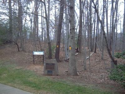
Location. 38° 37.172′ N, 77° 16.671′ W. Marker is near Woodbridge, Virginia, in Prince William County. Marker is at the intersection of Forest Grove Drive and Rippon Boulevard (County Route 784), on the right when traveling north on Forest Grove Drive. Marker is near a small park, on the NE corner of the intersection. Touch for map. Marker is at or near this postal address: 2114 Rippon Boulevard, Woodbridge VA 22191, United States of America. Touch for directions.
Other nearby markers. At least 8 other markers are within walking distance of this marker. The Old Potomac Path (here, next to this marker); The Potomac Path (within shouting distance of this marker); Rippon Lodge (approx. ¼ mile away); Centuries of History (approx. ¼ mile away); Historic Landscape (approx. 0.3 miles away); Latrobe's View (approx. 0.3 miles away); a different marker also named Potomac Path (approx. 0.3 miles away); Neabsco Creek (approx. 0.4 miles away). Touch for a list and map of all markers in Woodbridge.
More about this marker. On the lower left is a modern-day picture of the Potomac Path. Its caption reads, "Sections of the King’s Highway are still visible near Rippon Lodge and in other areas in Prince William County." The photo was taken by Brandon Hanifin.
On the upper right is a picture taken at the dedication of the nearby Old Potomac Path marker. Its caption reads, "Judge Wade Hampton Ellis (left), his wife and several members of the Susan Revere Hetzel Chapter of the Daughters of the American Revolution posed in front of their King’s Highway plaque in May, 1933. The plaque now stands near the Mary G. Porter Traditional School on Rippon Boulevard." The marker identifies the source as
Prince William County Historic Preservation Division
Credits. This page was last revised on June 30, 2023. It was originally submitted on March 4, 2008, by Kevin W. of Stafford, Virginia. This page has been viewed 1,728 times since then and 23 times this year. Photos: 1, 2. submitted on March 4, 2008, by Kevin W. of Stafford, Virginia.

