Osprey in Sarasota County, Florida — The American South (South Atlantic)
Historic Spanish Point
Inscription.
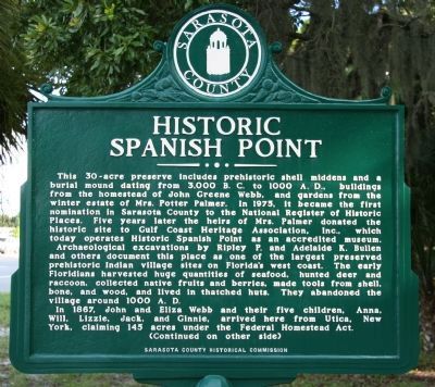
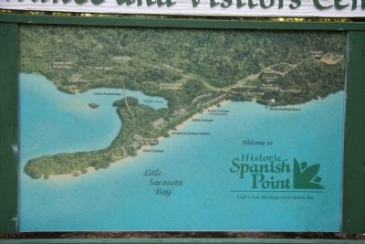
This 30-acre preserve includes prehistoric shell middens and a burial mound dating from 3,000 B.C. to 1,000 A.D., buildings from the homestead of John Greene Webb, and gardens from the winter estate of Mrs. Potter Palmer. In 1975, it became the first nomination in Sarasota County to the National Register of Historic Places. Five years later the heirs of Mrs. Palmer donated the historic site to Gulf Coast Heritage Association, Inc., which today operates Historic Spanish Point as an accredited museum.
Archaeological excavations by Ripley P. and Adelaide K. Bullen and others document this place as one of the largest preserved prehistoric Indian villages sites on Florida's west coast. The early Floridians harvested huge quantities of seafood, hunted deer and raccoon, collected native fruits and berries, made tools from shell, bone, and wood, and lived in thatched huts. They abandoned the village around 1000 A.D.
In 1867, John and Eliza Webb and their five children, Anna, Will, Lizzie, Jack, and Ginnie, arrived here from Utica, New York, claiming 145 acres under the Federal Homestead Act.
Reverse:
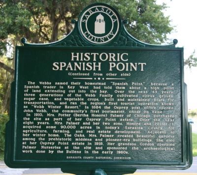
The Webbs named their homestead "Spanish Point," because a Spanish trader in Key West had told them about a high point of land extending out into the bay. Over the next 43 years, three generations of the Webb Family cultivated citrus groves, sugar cane, and vegetable crops, built and maintained boats for transportation, and ran the region's first tourist operation known as "Webb Winter Resort." In 1884 the Osprey post office opened. John Webb, the community's first postmaster, chose its name.
In 1910, Mrs. Potter (Bertha Honore) Palmer of Chicago purchased the site as part of her Osprey Point estate. Over the next eight years, Mrs. Palmer and her two sons, Honore and Potter II, acquired some 90,000 acres in today's Sarasota County for agriculture, farming, and real estate development. Adjacent to her winter home, The Oaks, Mrs. Palmer created beautiful gardens among the prehistoric middens and pioneer-era buildings. She died at her Osprey Point estate in 1918. Her grandson Gordon operated Palmer Nurseries at the site and sponsored the archaeological work done by the Bullens in the early 1960s.
Erected 1985 by Sarasota County Historical Commission.
Topics. This historical marker is listed in these topic lists: Anthropology & Archaeology • Native Americans • Settlements & Settlers. A significant historical year for this entry is 1975.
Location. 27° 12.121′ N, 82° 29.437′ W. Marker is in Osprey, Florida, in Sarasota County. Marker is at the intersection of North Tamiami
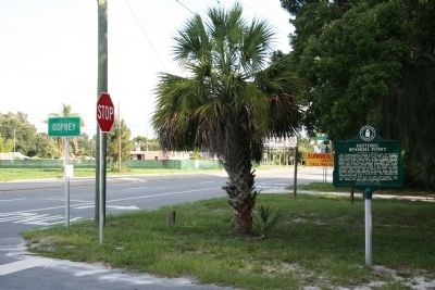
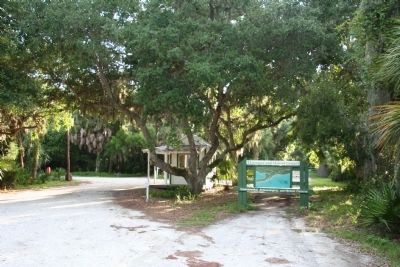
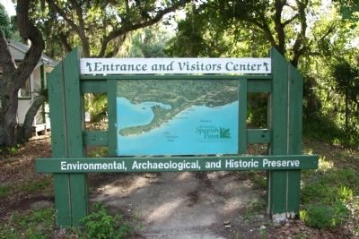
Trail (U.S. 41) and Spanish Point Road, on the left when traveling north on North Tamiami Trail. This historic marker is located on the Gulf coast side of the Tamiami Trail, at the entrance to the "Historic Spanish Point" facility. This site is located north of Venice, Florida and south of Sarasota, Florida. Touch for map. Marker is at or near this postal address: 500 North Tamiami Trail, Osprey FL 34229, United States of America. Touch for directions.
Other nearby markers. At least 8 other markers are within 6 miles of this marker, measured as the crow flies. Osprey School (about 300 feet away, measured in a direct line); Palmer Ranch (approx. 2 miles away); Oscar Scherer State Park (approx. 2.4 miles away); South Creek Trestle / Oscar Scherer History (approx. 2.7 miles away); Railroad History (approx. 3.4 miles away); Laurel Turpentine Company / Blackburn Sawmill Quarters (approx. 5 miles away); The Edson Keith Estate (approx. 5.4 miles away); Bee Ridge Woman's Club (approx. 5˝ miles away). Touch for a list and map of all markers in Osprey.
Credits. This page was last revised on June 21, 2018. It was originally submitted on November 22, 2010, by Dale K. Benington of Toledo, Ohio. This page has been viewed 1,474 times since then and 62 times this year. Last updated on October 15, 2012, by Max Feldbaum of San Francisco, California. Photos: 1, 2, 3, 4, 5, 6. submitted on November 23, 2010, by Dale K. Benington of Toledo, Ohio.
