
Les berges du Tarn
The Tarn Riverbanks
English:
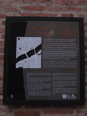
The Tarn Riverbanks
The Left Bank of the Tarn has been densely inhabited since the High Middle Ages. It is called the “Combe” (valleys) district.
Topographically speaking, the name invokes the “gutter” shape that tapers down to the Tarn. Life in the Combes area was defined by inhabitants’ relationship with the river,
this page online
A product of urban growth, the Old Bridge (pont-Vieux), built in the 11th century to ease the flow of traffic and facilitate trade, led to the development of the “du-Bout-du-Pont” suburb (“End-of-Bridge”) on the Right Bank, today the Madeleine neighborhood.
The street Engueysse, which bears the surname of the Engueysse family, was until the end of the 18th century a vital thoroughfare for goods moving from Vielh Port and the Old Bridge towards the city and Place de la Pile.
Spanish:
La ribera del Tarn
La margen izquierda del Tarn ha estado habitada desde la Alta Edad Media en la zona que se conoce como les Combes.
El nombre hace referencia a la topografía de la región. Este barrio desempeñaba un importante papel de conexión entre la ciudad y el río, fuente de una intensa actividad comercial.
El Puente Viejo data del siglo XI, en el que se produjo un gran crecimiento urbano. Su construcción, que respondía al aumento de la circulación y al deseo de potenciar el comercio, impulsó el desarrollo del actual barrio de la Madeleine, situado en la margen derecha.
La rue d´Engueysse

Erected by Ville d’Albi.
Topics. This historical marker is listed in these topic lists: Roads & Vehicles • Waterways & Vessels.
Location. 43° 55.78′ N, 2° 8.638′ E. Marker is in Albi, Occitanie (Occitania), in Tarn. It is at the intersection of Rue d''Engueysse and Quai Choisel on Rue d''Engueysse. Touch for map. Marker is in this post office area: Albi, Occitanie 81000, France. Touch for directions.

Regionally, it is in the North Atlantic Region, Europe, the European Union, Atlantic Europe, the Schengen Area, Western Europe, a coastal Mediterranean country, and the Western World. Historically, it finds itself in what was once a French colony and also the Roman Empire.
Other nearby markers. At least 8 other markers are within walking distance of this marker: Hôtel de Fenasse (about 90 meters away, measured in a direct line); Le palais de la Berbie

Credits. This page was last revised on September 10, 2018. It was originally submitted on October 16, 2012, by Barry Swackhamer of Brentwood, California. This page has been viewed 517 times since then and 14 times this year. Photos: 1, 2, 3. submitted on October 16, 2012, by Barry Swackhamer of Brentwood, California. • Bill Pfingsten was the editor who published this page.
