Syracuse in Morgan County, Missouri — The American Midwest (Upper Plains)
Butterfield Overland Mail in Missouri - 1858-1861
Photographed by William Fischer, Jr., January 22, 2012
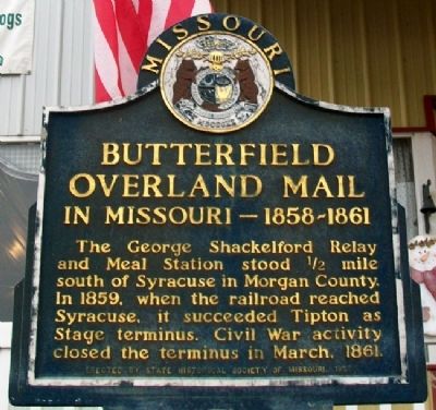
1. Butterfield Overland Mail in Missouri - 1858-1861 Marker
The George Shackelford Relay and Meal Station stood ½ miles south of Syracuse in Morgan County. In 1859, when the railroad reached Syracuse, it succeeded Tipton as Stage terminus. Civil War activity closed the terminus in March, 1861.
Erected 1958 by State Historical Society of Missouri.
Topics and series. This historical marker is listed in these topic lists: Communications • Roads & Vehicles • Settlements & Settlers • War, US Civil. In addition, it is included in the Butterfield Overland Mail, and the Missouri, The State Historical Society of series lists. A significant historical month for this entry is March 1861.
Location. 38° 40.184′ N, 92° 52.43′ W. Marker is in Syracuse, Missouri, in Morgan County. It is on Front Street (U.S. 50) east of Washington Street, on the right when traveling east. Touch for map. Marker is at or near this postal address: 218 East Front Street, Syracuse MO 65354, United States of America. Touch for directions.

Regionally, this marker is in the Missouri River Corridor. It is also in the American Midwest, in the Lewis & Clark Corridor, and in the Corn Belt. Globally,
this page online
Other nearby markers. At least 8 other markers are within 11 miles of this marker, measured as the crow flies: Site of First St. Andrew Catholic Church (approx. 4.3 miles away); Tipton (approx. 4.9 miles away); The Maclay Home (approx. 5 miles away); First Presbyterian Church (approx. 5 miles away); William Tipton Seely (approx. 5.2 miles away); Tipton Methodist Church Bell (approx. 5.3 miles away); Harrison School (approx. 5.4 miles away); Mulholland Station (approx. 10.9 miles away).
Also see . . . Butterfield Overland Mail. Handbook of Texas website entry (Submitted on November 26, 2012, by William Fischer, Jr. of Reynoldsburg, Ohio.)
Photographed by William Fischer, Jr., January 22, 2012
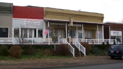
2. Butterfield Overland Mail in Missouri - 1858-1861 Marker

Photographed by Gregory William Wadley, November 26, 2024
3. Butterfield Overland Mail Route Pettis, Morgan, and Moniteau Counties in Missouri
The Butterfield Overland Mail Co. carried its first U.S. mail westward beginning September 16, 1858, with the company president, John W. Butterfield Sr., taking custody of two mailbags at St. Louis and boarding a Pacific Railroad train for Tipton, Missouri and then continuing west on the Stage. Then in August 1, 1859 the railroad depot in Syracuse became the terminus of the Butterfield route when the railroad extended the line to there.
Credits. This page was last revised on December 27, 2024. It was originally submitted on November 26, 2012, by William Fischer, Jr. of Reynoldsburg, Ohio. This page has been viewed 1,361 times since then and 76 times this year. Photos: 1, 2. submitted on November 26, 2012, by William Fischer, Jr. of Reynoldsburg, Ohio. 3. submitted on November 26, 2024, by Gregory William Wadley of Fremont Hills, Missouri.
