Susan B. Anthony in Rochester in Monroe County, New York — The American Northeast (Mid-Atlantic)
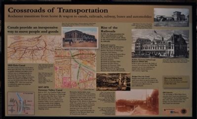
Crossroads of Transportation
Rochester transitions from horse & wagon to canals, railroads, subway, buses and automobiles
1825 The Erie Canal
The Erie Canal connects the Hudson River and Lake Erie. The 363 miles of navigable waterway provided a cost-efficient way to transport goods to and from the Great Lakes to New York City and every village in between. Before the canal it cost $100 to ship one ton of goods from New York City to Buffalo, NY. After the canal was completed the same ton could be shipped for $10.
1837-1878 Genesee Valley Canal
Built in 1837, the Genesee Valley Canal was to connect Rochester to Pittsburgh, PA, and the rich Ohio River Valley via the Allegheny River at Olean, NY. The junction of the Erie Canal and Genesee Valley Canal completed the east-west/north-south shipping connections and made Rochester an important transportation and shipping center. Boatyards, lumber mills, ships, chandlers, warehouses, dock workers, teamsters, liveries, cooks and farmers all thrived in the heyday of the canals. The first cargo was carried from Rochester to Mt. Morris in September, 1840. The canal closed in 1878, not having realized the market potential of the Ohio River Valley before railroads took over much of the business. The canal bed became the railbed for the Western New York & Pennsylvania Railroad.
Rise of the Railroads
in 1874, the State permitted the sale or abandonment of most of the State--owned canals. Many of the canal beds were purchased by railroads. Railroads listed in Rochester 1890 City Directory: Avon, Genesco & Mt Morris • Buffalo, Rochester & Pittsburgh • Genesee Falls Railway • New York Central & Hudson River • New York Lake Erie & Western • Rochester Electric Railway • Rochester Railway • Rochester & Genesee Valley • Rochester & Glen Haven • Rochester & Honeoye Valley • Rochester & Lake Ontario • Rome, Watertown & Ogdensburg • Western New York & Pennsylvania
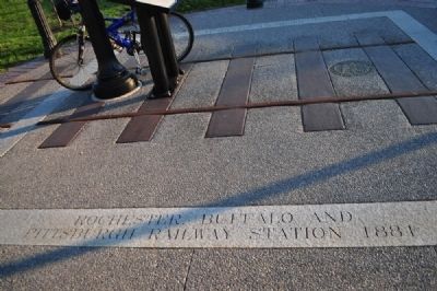
Buffalo Rochester & Pittsburgh Railroad (BR&P RR)
Built to carry coal from the fields of western Pennsylvania, the BR&P RR operated out of this building that stands today-shown in a 19th century engraving.
Bridges Over the Canal
Bridges were built over the canal at each cross street as can be seen in the illustration at the left. Bridges were constructed to allow boats to pass underneath.
Old Calamity
The lift bridge at West Main Street over the Erie Canal was nicknamed "Old Calamity" for its fitful operation that often tied up road traffic. The bridge was demolished when the Erie Canal was relocated.
b> Historical Hiking Trails
Many of the old canal and railroad beds have been converted to hike/bike trails.
Erected by City of Rochester, NY - The Community Foundation.
Topics and series. This historical marker is listed in these topic lists: Industry & Commerce • Man-Made Features • Railroads & Streetcars • Waterways & Vessels. In addition, it is included in the Erie Canal series list. A significant historical month for this entry is September 1840.
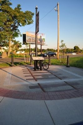
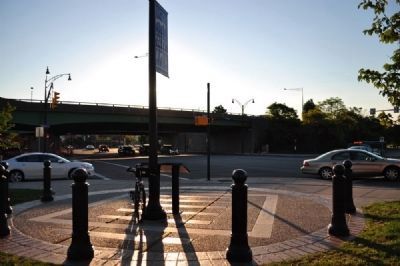
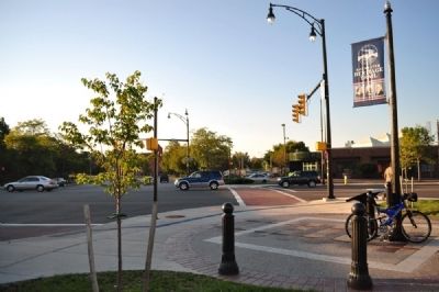
Location. 43° 9.238′ N, 77° 37.245′ W. Marker is in Rochester, New York, in Monroe County. It is in Susan B. Anthony. Marker is at the intersection of West Main Street (New York State Route 33) and Broad Street (New York State Route 31), on the left when traveling east on West Main Street. Touch for map. Marker is in this post office area: Rochester NY 14608, United States of America. Touch for directions.
Other nearby markers. At least 8 other markers are within walking distance of this marker. Susan B. Anthony Voted Here (approx. 0.2 miles away); Jonathan Child (approx. 0.2 miles away); Hervey Ely House (approx. ¼ mile away); Ely House - 1837 (approx. ¼ mile away); Have honor for Nathaniel Rochester (approx. ¼ mile away); Rochester: Center of Freedom (approx. ¼ mile away); First RIT Campus (approx. ¼ mile away); Post House (approx. ¼ mile away). Touch for a list and map of all markers in Rochester.
Credits. This page was last revised on February 16, 2023. It was originally submitted on December 16, 2012, by Yugoboy of Rochester, New York. This page has been viewed 535 times since then and 21 times this year. Photos: 1, 2, 3, 4, 5. submitted on December 16, 2012, by Yugoboy of Rochester, New York. • Bill Pfingsten was the editor who published this page.
