Imperial in Imperial County, California — The American West (Pacific Coastal)
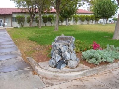
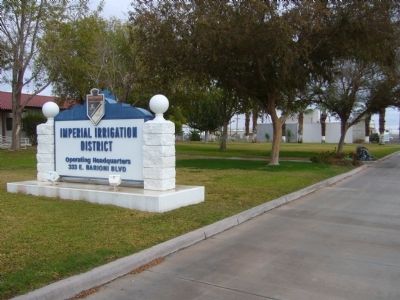
Imperial Irrigation District
They commenced power service in 1936 and now supply power to the Imperial and Eastern Coachella Valleys. They aggressively guard the Imperial Valley's long established water rights to insure that the Imperial Valley remains one of the most productive agricultural areas in the world.
Erected 2004 by the Native Sons of the Golden West - Richard S. Kimball, Grand President.
Topics and series. This historical marker is listed in these topic lists: Agriculture • Industry & Commerce • Natural Resources • Waterways & Vessels. In addition, it is included in the Native Sons/Daughters of the Golden West series list. A significant historical year for this entry is 1911.
Location. 32° 50.855′ N, 115° 34.013′ W. Marker is in Imperial, California, in Imperial County. Marker is on East Barioni Boulevard, on the right when traveling west. Touch for map. Marker is at or near this postal address: 333 East Barioni Boulevard, Imperial CA 92251, United States of America. Touch for directions.
Other nearby markers. At least 8 other markers are within 8 miles of this marker, measured as the crow flies. Imperial Valley Press (approx. 3.7 miles away); Women's 10,000 Club (approx. 4 miles away); Mobley Meadows (approx. 4 miles away); Imperial Valley Veterans' Memorial (approx. 4 miles away); Pearl Harbor Survivors Memorial (approx. 4 miles away); McConnell Ranch (approx. 5.1 miles away); Mormon Battalion (approx. 7.8 miles away); Rock Art (approx. 7.9 miles away). Touch for a list and map of all markers in Imperial.
Credits. This page was last revised on June 16, 2016. It was originally submitted on December 21, 2012, by Bill Kirchner of Tucson, Arizona. This page has been viewed 655 times since then and 16 times this year. Photos: 1, 2, 3. submitted on December 21, 2012, by Bill Kirchner of Tucson, Arizona. • Syd Whittle was the editor who published this page.


