
Marker Logo
THE HISTORICAL
MARKER DATABASE
“Bite-Size Bits of Local, National, and Global History”
Near Jeffrey City in Fremont County, Wyoming — The American West (Mountains)
 

Ice Slough
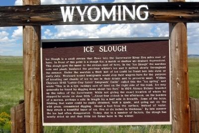
 
 
Ice Slough Marker image. Click for full size.
Photographed by Duane Hall, July 31, 2010
1. Ice Slough Marker
Inscription. Ice Slough is a small stream that flows into the Sweetwater River five miles east of here. In front of this point is a slough (i.e. a marsh or shallow un-drained depression). This slough gave the name to the stream east of here. In the "Ice Slough" the marshes soils and plants insulated the previous winter's ice and it melted slowly throughout the summer. Under the marshes a thick mat of ice could be found late into June or early July. Westward bound immigrants would stop their wagons here for the purpose of breaking out chunks of ice to use in their drinks and to preserve meat. William Clayton's 1848 "Latter-Day Saints' Emigrants' Guide" called this the "ice spring" and wrote "This is in a low, swampy spot of land on the right side of the road. Ice may generally be found by digging down about two feet." In 1854 Alonzo Delano traveled up the valley of the Sweetwater. While not giving the exact location of where he stopped he wrote on June 26th "... About four o'clock in the afternoon, on the borders of a morass, perhaps a mile in length by a half mile in breadth. Some of the boys, thinking that water could be easily obtained,
Paid Advertisement
Click or scan to see
this page online
took a spade, and going out on the wild grass, commenced digging. About a foot from the surface, instead of water, they struck a beautiful layer of ice, five or six inches in thickness." By late summer the ice had often disappeared. Today, due to a number of factors, the slough has nearly dried up and thus little ice forms here in the winter.
 
Topics and series. This historical marker is listed in these topic lists: Natural FeaturesRoads & Vehicles. In addition, it is included in the California Trail, the Mormon Pioneer Trail, and the Oregon Trail series lists. A significant historical year for this entry is 1848.
 
Location. 42° 31.039′ N, 108° 0.514′ W. Marker is near Jeffrey City, Wyoming, in Fremont County. It is on U.S. 287 1.7 miles west of Happy Springs Rd, on the right when traveling west. The marker is located along the route of the California - Mormon - Oregon Trail. Touch for map. Marker is in this post office area: Jeffrey City WY 82310, United States of America. Touch for directions.

Regionally, this marker is in Wind River Country. It is also in the American Mountain West. Globally, it is in North America, the
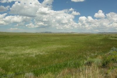
Ice Slough on the California - Mormon - Oregon Trail image. Click for full size.
Photographed by Duane Hall, July 31, 2010
2. Ice Slough on the California - Mormon - Oregon Trail
Rocky Mountains, the Western Hemisphere, the Western World, and the Anglosphere.

Other nearby markers. At least 7 other markers are within 10 miles of this marker, measured as the crow flies: Women of Sixth Crossing (approx. 9 miles away); Gold Flakes to Yellowcake Historic Mine Trail (approx. 9.2 miles away); Jeffrey City (approx. 9.2 miles away); The Sweetwater Valley (approx. 9.4 miles away); Oregon Trail (approx. 9.4 miles away); Sweetwater Willows (approx. 9.4 miles away); Sweetwater Station (approx. 9.4 miles away).
 
 
Credits. This page was last revised on January 14, 2025. It was originally submitted on December 23, 2012, by Duane Hall of Abilene, Texas. This page has been viewed 3,898 times since then and 395 times this year. Photos:   1, 2. submitted on December 23, 2012, by Duane Hall of Abilene, Texas. • Bill Pfingsten was the editor who published this page.

m=62076

CeraNet Cloud Computing sponsors the Historical Marker Database.
This website earns income from purchases you make after using our links to Amazon.com. We appreciate your support.
Paid Advertisement
Jul. 22, 2026