
Fort Sill in Comanche County, Oklahoma — The American South (West South Central)
Apache Prisoner-of-War Cemeteries
Fort Sill, Oklahoma
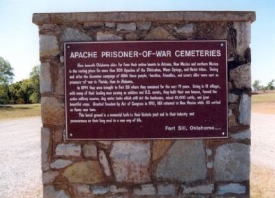
Photographed by Don Morfe, October 14, 2003
1. Apache Prisoner-of-War Cemeteries Marker
In 1894 they were brought to Fort Sill where they remained for the next 19 years. Living in 12 villages, with many of their leading men serving as soldiers and U.S. scouts, they built their own houses, fenced the entire military reserve, dug water tanks which still dot the landscape, raised 10,000 cattle, and grew bountiful crops. Granted freedom by Act of Congress in 1913, 183 returned to New Mexico while 82 settled on farms near here.
This ground is a memorial both to their historic past and to their industry and perseverance on their long road to a new way of life.
Topics. This historical marker is listed in these topic lists: Cemeteries & Burial Sites • Indigenous Peoples and Communities • Wars, US Indian. A significant historical year for this entry is 1886.
Location. 34° 41.762′ N,
this page online

Regionally, this marker is in Oklahoma’s Kiowa Tribe, in the Comanche Nation, and in Southwest Oklahoma. It is also in the American South, specifically on the prairies, and on the Southern Plains. Globally, it is in North America, the Western Hemisphere, the Western World, and the Anglosphere. Historically, it finds itself in what was once New Spain, the Comanchería, the territory of the Mississippian Culture, and the Louisiana Purchase.
Other nearby markers. At least 8 other markers are within 2 miles of this marker, measured as the crow flies: Apache Indian Cemeteries (here, next to this marker); Quinette Crossing (approx. 1.8 miles away); Post Chapel (approx. 1.9 miles away); Sherman House (approx. 1.9 miles away); Officers' Quarters (approx. 2 miles away); Infantry Company Quarters (approx.
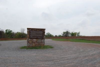
Photographed by Mike Wintermantel, April 8, 2015
2. Apache Prisoner-of-War Cemeteries Marker
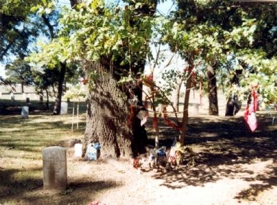
Photographed by Don Morfe, October 14, 2003
3. Apache Grave
Credits. This page was last revised on June 16, 2016. It was originally submitted on December 27, 2012, by Don Morfe of Baltimore, Maryland. This page has been viewed 1,345 times since then and 87 times this year. Photos: 1. submitted on December 27, 2012, by Don Morfe of Baltimore, Maryland. 2. submitted on April 13, 2015, by Mike Wintermantel of Pittsburgh, Pennsylvania. 3. submitted on December 27, 2012, by Don Morfe of Baltimore, Maryland. • Bernard Fisher was the editor who published this page.
