Near Stanton in Adams County, Mississippi — The American South (East South Central)
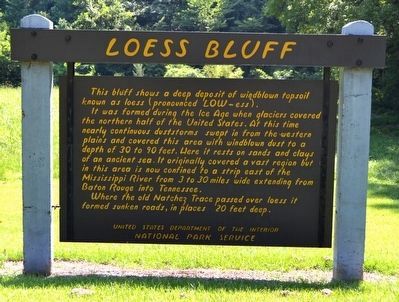
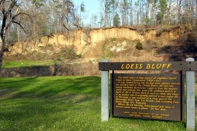
Loess Bluff
At this time nearly continuous duststorms swept in from the western plains and covered this area with windblown dust to a depth of 30 to 90 feet. Here it rests on sands and clays of an ancient sea. It originally covered a vast region but in this area is now confined to a strip east of the Mississippi River from 3 to 30 miles wide extending from Baton Rouge into Tennessee.
Where the old Natchez Trace passed over loess it formed sunken roads, in places 20 feet deep.
Erected by National Park Service.
Topics and series. This historical marker is listed in these topic lists: Environment • Roads & Vehicles. In addition, it is included in the Natchez Trace series list.
Location. 31° 38.798′ N, 91° 12.593′ W. Marker is near Stanton, Mississippi, in Adams County. Marker is on Natchez Trace Parkway (at milepost 12.4), 2.1 miles east of Mississippi Highway 553, on the right when traveling north. Touch for map. Marker is in this post office area: Natchez MS 39120, United States of America. Touch for directions.
Other nearby markers. At least 8 other markers are within 3 miles of this marker, measured as the crow flies. Emerald Mound (approx. 2.4 miles away); One Mound Among Many (approx. 2.4 miles away); Still Sacred (approx. 2.4 miles away); a different marker also named Emerald Mound (approx. 2.4 miles away); a different marker also named Emerald Mound (approx. 2.4 miles away); A Well-Organized Society (approx. 2.4 miles away); A Remarkable Feat (approx. 2.4 miles away); Mount Locust (approx. 3 miles away). Touch for a list and map of all markers in Stanton.
Credits. This page was last revised on June 16, 2016. It was originally submitted on December 27, 2012, by Duane Hall of Abilene, Texas. This page has been viewed 887 times since then and 59 times this year. Photos: 1. submitted on August 16, 2015, by Duane Hall of Abilene, Texas. 2. submitted on December 27, 2012, by Duane Hall of Abilene, Texas. 3. submitted on August 16, 2015, by Duane Hall of Abilene, Texas. • Craig Swain was the editor who published this page.


