La Plata in Charles County, Maryland — The American Northeast (Mid-Atlantic)
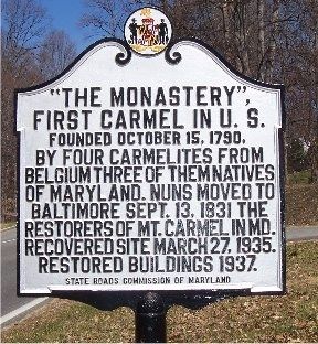
“The Monastery”
First Carmel in U. S.
— Founded October 15, 1790. —
Erected by State Roads Commission of Maryland.
Topics. This historical marker is listed in these topic lists: Churches & Religion • Colonial Era • Women. A significant historical month for this entry is March 1961.
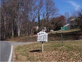
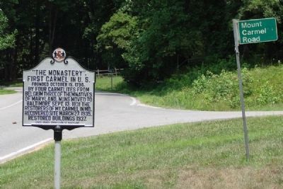
Location. 38° 33.41′ N, 77° 0.344′ W. Marker is in La Plata, Maryland, in Charles County. Marker is at the intersection of Mitchell Road and Mount Carmel Road, on the right when traveling north on Mitchell Road. It is directly across the street from the south entrance of the College of Southern Maryland, LaPlata campus. Touch for map. Marker is in this post office area: La Plata MD 20646, United States of America. Touch for directions.
Other nearby markers. At least 8 other markers are within 2 miles of this marker, measured as the crow flies. From Creek to the College of Southern Maryland (approx. 0.3 miles away); Friendship House....one of Charles County's Oldest (approx. 0.3 miles away); World War I Enlisted Military Memorial (approx. 1.8 miles away); Honor Roll (approx. 1.8 miles away); Vietnam Conflict Memorial (approx. 1.8 miles away); War on Terror Memorial (approx. 1.8 miles away); Korean Conflict Memorial (approx. 1.8 miles away); Lebanon / Grenada Conflict Veterans Memorial (approx. 1.8 miles away). Touch for a list and map of all markers in La Plata.
Credits. This page was last revised on June 6, 2022. It was originally submitted on March 15, 2008, by M. A. Pimentel of Waldorf, Maryland. This page has been viewed 1,377 times since then and 17 times this year. Photos: 1, 2. submitted on March 15, 2008, by M. A. Pimentel of Waldorf, Maryland. 3. submitted on May 15, 2008, by Richard White of La Plata, Maryland. • J. J. Prats was the editor who published this page.


