Copperopolis in Calaveras County, California — The American West (Pacific Coastal)
Copperopolis Historical Plaza
Photographed by Barry Swackhamer, August 25, 2012
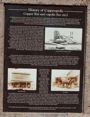
1. History of Copperopolis Marker
Photo captions, clockwise from the top, right:
Union Mine Rock Breaking Facility; Post Office; Union Mine Store.
Union Mine Rock Breaking Facility; Post Office; Union Mine Store.
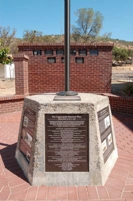
(There are five markers and one dedication plaque affixed to the flagpole pedestal.)
Copper (for ore) + opolos (for city)
Copper was discovered at a time when the Mother Lode gold mines were becoming inactive and the nation was involved in a civil war. After the ore was mined, it was loaded onto wagons and carted to Stockton. It was then placed on riverboats and taken to San Francisco. Then it was loaded onto sailing ships for the trip around the Horn to New York, Boston and Wales for smelting and processing. The U.S. Bureau of Mines credits the Copperopolis
this page online
Copperopolis started as a boomtown and grew rapidly for approximately seven years, (1860-1867) with an in-flux of speculators, prospectors, miners, and businessmen. Homes, hotels, saloons, livery stables, rooming houses, racetracks, 3 schools, churches, the Armory of the Union Guard and even a bowling alley were built. At its historic height, the number of residents living in Copperopolis was over 4,000, about the same as the population in 2010. The local newspaper, The Copperopolis Courier carried the news of the day. The people of Copperopolis named
Photographed by Barry Swackhamer, August 25, 2012
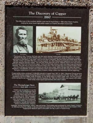
2. The Discovery of Copper Marker and Honigsberger Store Marker
Photo captions: clockwise from the top,left:
Hiram Hughes; Ore Cars; The Honigsberger Store.
Hiram Hughes; Ore Cars; The Honigsberger Store.
The original town center was located across from the Armory and was known as “The Plaza.” During the copper boom, Main Street was lined with buildings of all shapes and sizes. Many buildings were constructed from bricks hauled in from Columbia, where many of the buildings were being torn down so the miners could mine the ground below. Copperopolis virtually became a company town during the boom; everyone worked for the mines, either directly or indirectly. The Copper Company even operated their own store, and named it the Union Mine Store. They also built boarding houses, stables, and housing for the workers. The “company store" was used by the Union Mine, Ames Company, Union Mining Company and Calaveras Copper Company. The exact date of construction is not certain. It has been an ice cream store, saloon and general store and even a restaurant and inn, but remained under mine ownership until the final mine closure in the 1940’s. The name changed several
Photographed by Barry Swackhamer, August 25, 2012
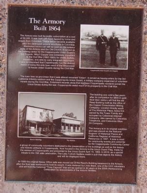
3. The Armory Marker
Photo captions:
Top, right; bottom, left: Copperopolis Union Guard’s 3rd Brigade; Reed’s Building, The Armory.
Top, right; bottom, left: Copperopolis Union Guard’s 3rd Brigade; Reed’s Building, The Armory.
The small building attached to the south was built separately between 1880 and 1895 to house the post office. In 1941 it was moved next to and attached to the store.
Second Marker:
1860
Previously to that, Thomas McCarty saw the same strange looking green minerals stuck to his wagon wheels in the mud, so when William Reed, a miner from the copper rich mines in Wisconsin, brought specimens to McCarty's "Log Cabin" store on his way to Stockton, McCarty knew just where Reed made the find. At the Log Cabin that day a mining engineer, Dr. Allen Blatchly just happened to be there and told him what he had was copper. The next day Reed, McCarty and Dr. Blatchly went to the area where McCarty and Reed had discovered copper. Reed and McCarty staked a claim two miles
Photographed by Barry Swackhamer, August 25, 2012
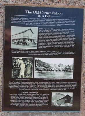
4. The Old Corner Saloon Marker
Photo captions:
Clockwise from the top, left: The Old Corner Saloon; Mule Team Hauling Freight on Main Street; O’Byrnes Ferry Bridge; Black Bart (far right) at Old Corner.
Copperopolis mines produced 72,598,883 pounds of copper from 1861 to 1946, Calaveras County became the second largest copper-producing district under northern control during the Civil War. In the 1860's that equated to over $12 million worth of copper, or over $200 million in today's dollar value. The two principal mines during the war were the Union, and the Keystone. By 1864, The Union Mine was valued at $2 million, which today would equal approximately $35 million dollars.
Built 1866
Photographed by Barry Swackhamer, August 25, 2012
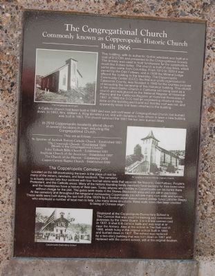
5. The Congregational Church Marker
Photo captions: Top, center, bottom: The Congregational Church; St. Ignatius of Anitoch Roman Catholic Church; Copperopolis Elementary School.
Third Marker:
Built 1864
The town was so pro-Union that
Photographed by Barry Swackhamer, August 25, 2012
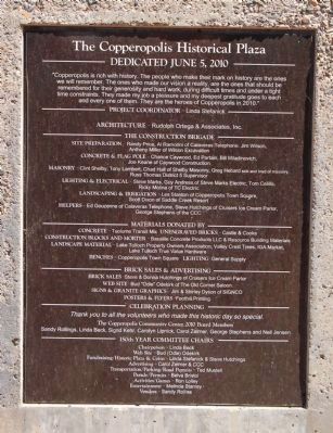
6. Dedication Plaque
Click on image to enlarge.
The building was sold a few years after its completion for $800 in gold. Next door visitors will find the old Reed Building built as the office of the Copper Consolidated Mining Company. Located directly south of The Historical Plaza, today it is owned by the Tower Family and is occupied by Calaveras Internet Company, also owned by Calaveras Telephone, and Calaveras Olive Oil Company.
The Armory is in its original condition and was placed on the National Register of Historical Places and California Register of Historical Resources in 1997. It now is used for community events and cared for by the Copperopolis Community Center, a group of community volunteers dedicated to the preservation of the buildings as well as the history and historic artifacts in Copperopolis. Now housed in the Armory is the Union Guard Flag, made by the women of Copperopolis and presented
Photographed by Barry Swackhamer, August 25, 2012
7. Copperopolis Historical Plaza Markers and Flagpole
In 1999 the original Assay Office safe was moved out of the Reed’s Building basement to the Armory, after the floor was reinforced to hold its weight. It was restored by Linda Beck, one of the CCC volunteers and will hold the historical “Time Capsule” that will be opened in 50 years at the 200th Homecoming Celebration by descendants of the historic families.
Fourth Marker:
Built 1862
Born in England in 1829 as Charles E. Boles, the legend of Black
Photographed by Barry Swackhamer, August 25, 2012
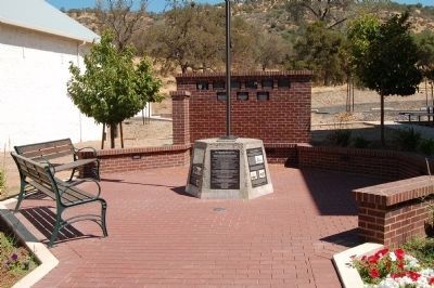
8. Copperopolis Historical Plaza Marker(s) and Flagpole
Donor plaque wall is seen in the background.
Although legend has it that the stone building behind the Armory and Honigsberger store was the jail, it actually was a storehouse. Copperopolis never had a jail and still does not today. The pathway behind the storehouse was the old stage route to Sonora.
Reeds Turnpike in Copperopolis was one of the principal routes for bringing freight into Angels Camp, Murphys and Sonora. Reeds Turnpike which ran from Copperopolis to
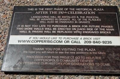
Photographed by Barry Swackhamer, August 25, 2012
9. Donations Plaque
(This plaque is mounted on top of the flagpole pedestal)
Click on photo to read.
Click on photo to read.
Fifth Marker:
Commonly known as Copperopolis Historic Church
Built 1866
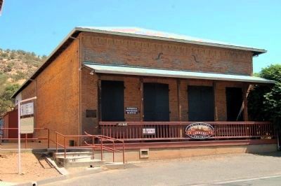
Photographed by Barry Swackhamer, August 25, 2012
10. The Armory
A Catholic church had been built in 1861 and was just northwest of Congregational Church, but burned down. In 1863, Mrs. William A. King donated a lot, and with donations from others in
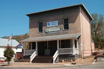
Photographed by Barry Swackhamer, August 25, 2012
11. The Former Reed's Building
In 2010 Copperopolis residents attend church in several locations in town including the Congregation Church.
St. Ignatius of Antioch Catholic Church – Established 1861
The Crossroads Church – Established 1980
(Meets in the Congregational Church)
Lake Tullock Bible Church – Established 1991
Anglican Church of the Ascension – Established 1997
The Church of the Harvest – Established 2005
Copper Canyon Baptist Church – Established 2006
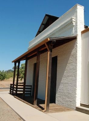
Photographed by Barry Swackhamer, August 25, 2012
12. Honigsberger Store
Displayed at the Copperopolis Elementary School is the Cannon that was used for training and ceremonial purposes by the Union Guard. It is a brass cannon cast in 1837. It shot 6 lb cannon balls and was kept at or near the Armory. Also at the school is The Bell cast in 1860, which hung in the original school built in 1865 and burned down in 1907. The school was replaced by a two-story building that was torn down in 1967 and replaced with the current school, still at the original location.
Topics and series. This historical marker is listed in these topic lists: Bridges & Viaducts • Religion & Religious Structures • Roads & Vehicles • Settlements & Settlers • War, US Civil. In addition, it is included
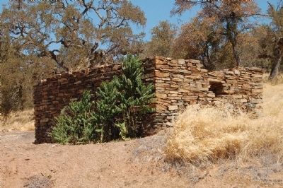
Photographed by Barry Swackhamer, August 25, 2012
13. Storehouse
Location. 37° 58.563′ N, 120° 38.152′ W. Marker is in Copperopolis, California, in Calaveras County. It is on Main Street, on the right when traveling north. Touch for map. Marker is at or near this postal address: 660 Main Street, Copperopolis CA 95228, United States of America. Touch for directions.

Regionally, this marker is in the Sierra Nevada. It is also in the American Mountain West. Globally, it is in North America, on the Pacific Rim, in the Western Hemisphere, in the Western World, and in the Anglosphere. Historically, it finds itself in what was once New Spain and also Mexico’s Alta California.
Other nearby markers. At least 8 other markers are within walking distance of this marker: Copperopolis Armory (within shouting distance of this marker); The Old Corner Saloon (approx. 0.2 miles away); Copperopolis (approx. 0.2 miles away); Calaveras Telephone (approx. 0.2 miles away); Thomas McCarty (approx. 0.3 miles away); Copperopolis Cemetery (approx. 0.3 miles away); Congregational Church (approx. 0.3 miles away); a different marker also
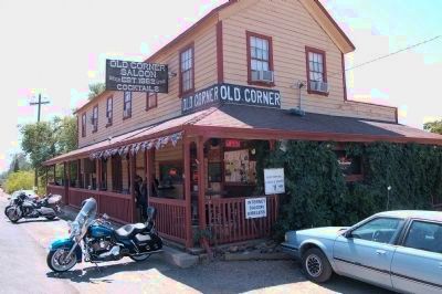
Photographed by Barry Swackhamer, August 25, 2012
14. Old Corner Saloon
Regarding Copperopolis Historical Plaza. Click on the "Click for a list of all markers in Copperopolis" in the Other Nearby Marker section for additional markers and photos of the sites and buildings mentioned in the marker(s) text.
Also see . . .
1. Copperopolis History - Calaveras History.org. From its beginnings in 1860 to the end of World War II, Copperopolis has been directly related to and affected by the extraction and production of copper ore. Copper was first discovered in the area in 1860 by Hiram Hughes on Gopher Ridge at Quail Hill, and a few months later at the Napoleon Mine on Hog Hill, about six miles southwest of Copperopolis. (Submitted on January 4, 2013, by Barry Swackhamer of Brentwood, California.)
2. Black Bart - California's Infamous Stage Robber. Black Bart was one of the most unusual stagecoach robbers in American history. There is no record of Bart ever firing a shot in any of his robberies. Bart, however, was not so lucky. (Submitted on January 4, 2013, by Barry Swackhamer of Brentwood, California.)
Additional keywords. Black Bart
Credits. This page was last revised on June 16, 2016. It was originally submitted on January 4, 2013, by Barry Swackhamer of Brentwood, California. This page has been viewed 3,441 times since then and 90 times this year. Photos: 1, 2, 3, 4, 5, 6, 7, 8, 9, 10, 11, 12, 13, 14. submitted on January 4, 2013, by Barry Swackhamer of Brentwood, California. • Syd Whittle was the editor who published this page.
