Near Manassas in Prince William County, Virginia — The American South (Mid-Atlantic)
Pittsylvania
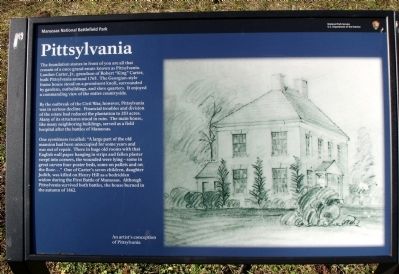
By the outbreak of the Civil War, however, Pittsylvania was in serious decline. Financial troubles and division of the estate had reduced the plantation to 283 acres. Many of its structures stood in ruin. The main house, like many neighboring buildings, served as a field hospital after the battles of Manassas.
One eyewitness recalled: “A large part of the old mansion had been unoccupied for some years and was out of repair. There in huge old rooms with that English wall paper hanging in strips and fallen plaster swept into corners, the wounded were lying – some in great carven four-poster beds, some on pallets and on the floor…” One of Carter’s seven children, daughter Judith, was killed on Henry Hill as a bedridden widow during the First Battle of Manassas. Although Pittsylvania survived both battles, the house burned in the autumn of 1862.
Erected by Manassas National Battlefield Park, National Park Service, U.S. Department of the Interior.
Topics. This historical marker is listed in this topic list: War, US Civil. A significant historical year for this entry is 1765.
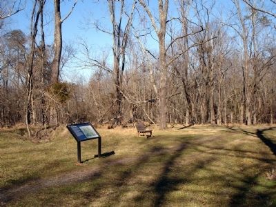
Location. 38° 49.77′ N, 77° 31.301′ W. Marker is near Manassas, Virginia, in Prince William County. Marker can be reached from Lee Highway (U.S. 29). Marker is located along the First Manassas Trail at Manassas National Battlefield Park. Closest parking is at Stone Bridge parking lot - MNBP Driving Tour Stop No. 12. Touch for map. Marker is in this post office area: Manassas VA 20109, United States of America. Touch for directions.
Other nearby markers. At least 8 other markers are within walking distance of this marker. Carter Cemetery (about 300 feet away, measured in a direct line); George T. Stovall (approx. 0.4 miles away); 8th Georgia Infantry (approx. 0.4 miles away); 71st New York State Militia (approx. 0.4 miles away); 2nd New Hampshire Infantry (approx. half a mile away); U.S. Infantry Battalion (approx. half a mile away); The Matthew Farm (approx. half a mile away); 4th Alabama Infantry (approx. half a mile away). Touch for a list and map of all markers in Manassas.
More about this marker. On the right of the marker is a sketch captioned An artist's conception of Pittsylvania.
Credits. This page was last revised on June 16, 2016. It was originally submitted on January 18, 2013. This page has been viewed 876 times since then and 24 times this year. Photos: 1, 2, 3, 4. submitted on January 18, 2013. • Craig Swain was the editor who published this page.


