Leonardtown in St. Mary's County, Maryland — The American Northeast (Mid-Atlantic)
Trade on the Waterfront
Leonardtown Wharf
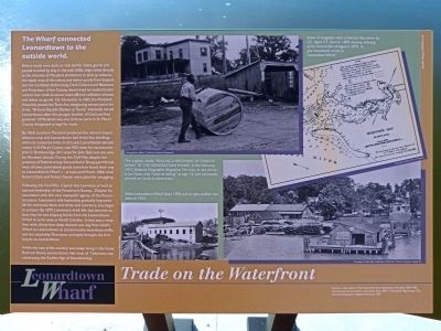
The Wharf Connected Leonardtown to the outside world.
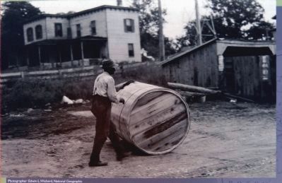
Before roads were built, or rails laid for trains, goods and people traveled by ship. In the mid-1600s, ships called directly at the wharves of Maryland plantations to pick up tobacco, the staple crop of the colony, and deliver goods from England and the Caribbean. Before long, Cecil Calvert, Lord Baltimore and Proprietor of the Colony, determined he needed better control over trade to assure more efficient collection of taxes and duties on goods. On November 6, 1685, the Maryland Assembly passed the Town Act, designating certain ports for trade. "Brittons Bay Bayleys or Taunts," eventually named Leonardtown, after the younger brother of Cecil and first governor of Maryland, was one of three ports in St. Mary's County designated as legal for trade.
By 1860, southern Maryland produced the nation's largest tobacco crop and Leonardtown had thirty-five dwellings within its corporate limits. In that year's presidential election voters in St. Mary's County cast 920 votes for John Bell, and one vote for Abraham Lincoln. During the Civil War, despite the presence of Federal Troops bivouacked in Sheep-pen Woods west of town, contraband goods somehow found their way to Leonardtown's Wharf -- at least until March, 1864, when Robert Clark and Robert Swann were jailed for smuggling.
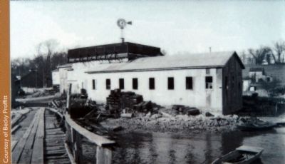
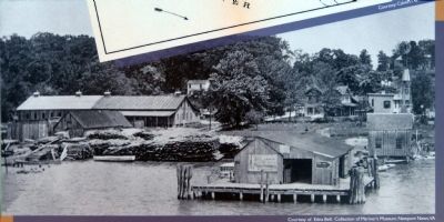
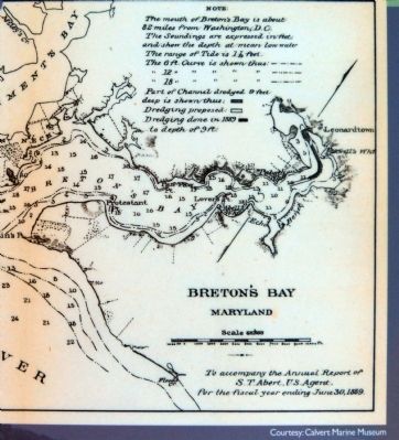
Following the Civil War, Captain Asa Lawrence arrive to assume leadership of the Freedman's Bureau. Despite his association with this very unpopular agency of the Reconstruction, Lawrence's able leadership gradually improved life for everyone, black and white, and Lawrence, too, began to prosper. By 1879, Lawrence's brick kiln had become so busy that he was shipping bricks from the Leonardtown Wharf to as far away as North Carolina. In that year, sixty-foot wide, thirty -foot deep channel was dug from Abell's Wharf to Leonardtown to accommodate steamboat traffic, and the steamship Thompson promptly brought the first bicycle to Leonardtown.
While the rest of the country was swept along in the Great Railroad Boom, Leonardtown, like most of Tidewater, was celebrating the Golden Age of Steamboating.
Sources:
Loker, Aleck; A Most Convenient Place, Leonardtown,Maryland 1650-1950.
Commissioners of Leonardtown and Solitude Press, 2001, "A Maryland Pilgrimage."
National Geographic Magazine, February 1927.
Topics. This historical marker is listed in these topic lists: Colonial Era • Industry & Commerce • War, US Civil. A significant historical month for this entry is February 1927.
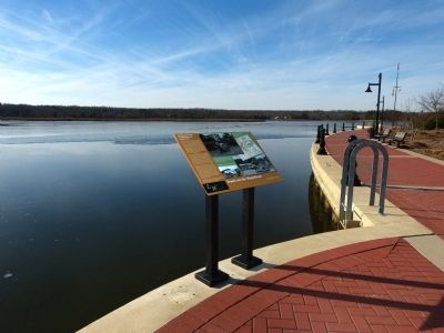
Location. 38° 17.155′ N, 76° 38.287′ W. Marker is in Leonardtown, Maryland, in St. Mary's County. Marker can be reached from Washington Street. Marker is in Leonardtown Wharf Park at the south end to Washington Street (MD 326) along the waterfront walkway. Touch for map. Marker is in this post office area: Leonardtown MD 20650, United States of America. Touch for directions.
Other nearby markers. At least 8 other markers are within walking distance of this marker. Fun on the Waterfront (here, next to this marker); Leonardtown Wharf (within shouting distance of this marker); Steamboats at the Waterfront (within shouting distance of this marker); Invasion! (within shouting distance of this marker); Origins of the Compass Rose (within shouting distance of this marker); Breton Bay (about 400 feet away, measured in a direct line); The Legend of Moll Dyer (approx. ¼ mile away); War Comes to Breton Bay (approx. ¼ mile away). Touch for a list and map of all markers in Leonardtown.
Photographed By Allen C. Browne, January 5, 2013
3. Rolling a Hogshead of Tobacco Down to the Leonardtown Wharf
The Caption reads: "ROLLING A HOGSHEAD OF TOBACCO DOWN TO THE LEONARDTOWN WHARF," in the February, 1927, National Geographic Magazine. The man in the photo is Joe Gunn, who "went to sailing" at age 15, and eventually worked on many a steamboat.
Credits. This page was last revised on June 16, 2016. It was originally submitted on January 19, 2013, by Allen C. Browne of Silver Spring, Maryland. This page has been viewed 642 times since then and 50 times this year. Photos: 1, 2, 3, 4, 5, 6. submitted on January 19, 2013, by Allen C. Browne of Silver Spring, Maryland. • Bill Pfingsten was the editor who published this page.
