Near Manassas in Prince William County, Virginia — The American South (Mid-Atlantic)
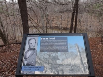
Farm Ford
First Battle of Manassas
— July 21, 1861 - 11 a.m. —
When ordered across Bull Run to join the fighting in progress on Matthews Hill, Sherman chose to use the shallow "farm ford" he had discovered earlier. His troops proceeded single file and met no opposition since the Confederates had departed to intercept the union flanking column. There was no established road to or from the ford, and the steep terrain prevented Sherman's artillery from joining the movement.
Erected 2012 by Manassas National Battlefield Park - National Park Service - Department of the Interior.
Topics. This historical marker is listed in this topic list: War, US Civil.
Location. 38° 49.675′ N, 77° 30.561′ W. Marker is near Manassas, Virginia, in Prince William County. Marker can be reached from Lee Highway (U.S. 29), on the right when traveling west. Located in the Manassas National Battlefield Park, along the Stone Bridge Trail loop. Touch for map. Marker is in this post office area: Manassas VA 20109, United States of America. Touch for directions.
Other nearby markers. At least 8 other markers are within walking distance of this marker. The Van Pelt House (approx. ¼ mile away); Opening Shots (approx. 0.3 miles away); a different marker also named Opening Shots (approx. 0.3 miles away); 4th South Carolina Infantry (approx. 0.3 miles away); Union Retreat (approx. 0.4 miles away); Strategic Crossing (approx. 0.4 miles away); Stone Bridge (approx. 0.4 miles away); Carter Cemetery (approx. 0.7 miles away). Touch for a list and map of all markers in Manassas.
Also see . . . Old Farm Ford Marker. This marker replaced an older version in 2012. (Submitted on February 6, 2013, by Craig Swain of Leesburg, Virginia.)
Credits. This page was last revised on June 16, 2016. It was originally submitted on February 6, 2013, by Matthew Holzman of Manassas, Virginia. This page has been viewed 872 times since then and 38 times this year. Photo 1. submitted on January 17, 2013, by Matthew Holzman of Manassas, Virginia. • Craig Swain was the editor who published this page.
