
Mount Pleasant in Maury County, Tennessee — The American South (East South Central)
Jonathan Webster
1767 - 1854

Photographed by Judith Barber, February 6, 2013
1. Jonathan Webster Marker
Erected by Tennessee Historical Commission. (Marker Number 3D 71.)
Topics. This historical marker is listed in these topic lists: Agriculture • Animals • Cemeteries & Burial Sites • Settlements & Settlers • War, US Revolutionary. A significant historical year for this entry is 1810.
Location. 35° 37.11′ N, 87° 13.455′ W. Marker is in Mount Pleasant, Tennessee, in Maury County. It is on Hampshire Pike (U.S. 412) 0.4 miles east of Booker Farm Road, on the right when traveling west. Touch for map. Marker is at or near this postal address: 3140 Hampshire Pike, Mount Pleasant TN 38474, United States of America. Touch for directions.

Regionally,
this page online
Other nearby markers. At least 8 other markers are within 6 miles of this marker, measured as the crow flies: Frierson Cemetery (approx. 1.3 miles away); Sam Watkins (approx. 4.7 miles away); Zion (approx. 4.7 miles away); Rattle and Snap Plantation (approx. 5.2 miles away); Delaying Forrest (approx. 5.6 miles away); St. John's (approx. 5.6 miles away); St. John's Episcopal Church (approx. 5.7 miles away); Forrest and Capron (approx. 5.7 miles away).
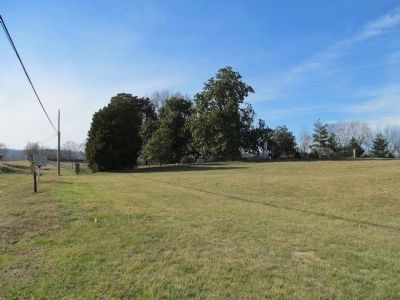
Photographed by Judith Barber, February 6, 2013
2. Jonathan Webster Marker
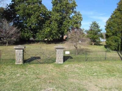
Photographed by Judith Barber, February 6, 2013
3. Jonathan Webster Marker
The cemetery where Jonathan Webster is buried.
Credits. This page was last revised on December 17, 2019. It was originally submitted on February 8, 2013, by Judith Barber of Marietta, Georgia. This page has been viewed 1,742 times since then and 109 times this year. Photos: 1, 2, 3. submitted on February 8, 2013, by Judith Barber of Marietta, Georgia. • Bernard Fisher was the editor who published this page.
