Sharp-Leadenhall in Baltimore, Maryland — The American Northeast (Mid-Atlantic)
Solo Gibbs Park
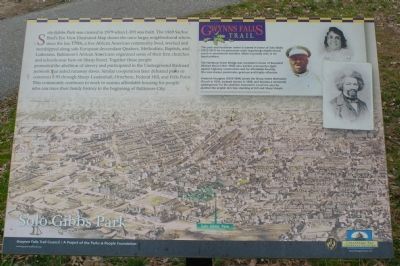
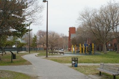
Solo Gibbs Park was created in 1979 when 1-395 was built. The 1869 Sachse Bird's Eye View Illustrated Map shows the once larger neighborhood where, since the late 1700s a free African American community lived, worked and worshipped along side European descendant Quakers, Methodists, Baptists, and Lutherans. Baltimore's African Americans organized some of their first churches and schools near here on Sharp Street. Together these people promoted the abolition of slavery and participated in the Underground Railroad network that aided runaway slaves. Similar cooperation later defeated plans to construct 1-95 through Sharp-Leadenhall, Otterbem, Federal Hill, and Fells Point. This community continues to work to sustain affordable housing for people who can trace their family history to the beginning of Baltimore City.
[Sidebar:]
This park and recreation center is named in honor of Solo Gibbs (1912-1977) for his passionate work organizing neighborhood youth in recreational activities. Gibbs is proudly seen in his band uniform.
The Hamburg Street Bridge was renamed in honor of Reverend Mildred Moon (1941-1992) who led this community's fight against highway construction and for affordable housing. She was passionate, gracious and highly effective.
Frederick Douglass (1818-1894) joined the Sharp Street Methodist Church in 1836, escaped from slavery in 1838, and became a renowned spokesperson for the abolition movement. Local lore says he planted the english elm tree standing at Hill and Sharp Streets.
Erected by Gwynns Falls Trail Council.
Topics and series. This historical marker is listed in these topic lists: Abolition & Underground RR • African Americans • Churches & Religion • Education • Parks & Recreational Areas. In addition, it is included in the Maryland, Gwynns Falls Trail series list. A significant historical year for this entry is 1979.
Location. 39° 16.712′ N, 76° 37.106′ W. Marker is in Baltimore, Maryland. It is in Sharp-Leadenhall. Marker can be reached from West Hamburg Street, on the right when traveling west. Marker is in Solo Gibbs Park. Touch for map. Marker is at or near this postal address: 200 W Hamburg St, Baltimore MD 21230, United States of America. Touch for directions.
Other nearby markers. At least 8 other markers are within walking distance of this marker. Struggling For Equality (within shouting distance of this marker); Gwynns Falls Trail (about 300 feet away, measured in a direct line); Leadenhall Baptist Church (about 500 feet away); From Bricks and Pianos to Football (about 800 feet away); Federal Hill and Otterbein (approx. 0.2 miles away); Ebenezer AME Church (approx. 0.2 miles away); Johnny Unitas (approx. 0.2 miles away); 8-10 Montgomery Street (approx. 0.2 miles away). Touch for a list and map of all markers in Baltimore.
Credits. This page was last revised on February 20, 2021. It was originally submitted on March 18, 2008, by Christopher Busta-Peck of Shaker Heights, Ohio. This page has been viewed 2,550 times since then and 58 times this year. Photos: 1, 2. submitted on March 18, 2008, by Christopher Busta-Peck of Shaker Heights, Ohio.

