Marker Logo HMdb.org THE HISTORICAL
MARKER DATABASE
“Bite-Size Bits of Local, National, and Global History”
Roy in Harding County, New Mexico — The American Mountains (Southwest)
 

Mills Canyon


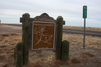
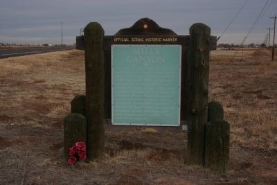
Mills Canyon Marker image. Click for full size.
Photographed By Wade Carrington, March 12, 2013
1. Mills Canyon Marker
Inscription. The site of one of New Mexico's most spectacular horticultural enterprises, the Orchard Ranch, established by Melvin W. Mills of Springer and notable for its skillfully engineered irrigation system. The ranch cultivated 12 miles of land along the Canadian River. Vegetable gardens and thousands of fruit trees flourished in the 1880's and later. A destructive flood wiped out orchards, irrigation system, buildings, and other improvements in 1904. They were never replaced.
 
Topics. This historical marker is listed in these topic lists: AgricultureHorticulture & ForestryWaterways & Vessels. A significant historical year for this entry is 1904.
 
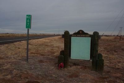
Location. 35° 56.039′ N, 104° 11.478′ W. Marker is in Roy, New Mexico, in Harding County. Marker is at the intersection of Richelieu Street (State Road 39 at milepost 67) and Floersheim Street, on the right when traveling north on Richelieu Street. Touch for map. Marker is in this post office area: Roy NM 87743, United States of America. Touch for directions.
 
Other nearby markers. At least 1 other marker is within 10 miles of this marker, measured as the crow flies. Canadian River Canyon (approx. 9˝ miles away).
 
Paid Advertisement
Click on the ad for more information.
Please report objectionable advertising to the Editor.
Click or scan to see
this page online
Mills Canyon Marker image. Click for full size.
Photographed By Wade Carrington, March 12, 2013
2. Mills Canyon Marker
Mills Canyon Marker image. Click for full size.
Photographed By Wade Carrington, March 12, 2013
3. Mills Canyon Marker
Back side of the marker
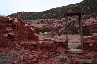
Ruins at Mills Canyon image. Click for full size.
Photographed By Wade Carrington, March 12, 2013
4. Ruins at Mills Canyon
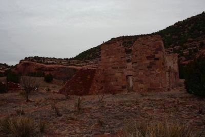
This is a picture of the ruins at Mills Canyon. The turn for the canyon is actually 10 miles north of Roy (location of the marker) off NM 39. You must then drive approximately 9 miles on dirt and gravel roads to get to the campground area where the ruins are located. The last few miles require at least a high clearance vehicle and possibly 4-wheel drive depending on weather.
The Ruins at Mills Canyon. image. Click for full size.
Photographed By Wade Carrington, March 12, 2013
5. The Ruins at Mills Canyon.
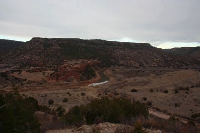
Mills Canyon Marker image. Click for full size.
Photographed By Wade Carrington, March 12, 2013
6. Mills Canyon Marker
View from Mills Canyon Road.
 
 
Credits. This page was last revised on June 16, 2016. It was originally submitted on March 17, 2013, by Wade Carrington of Colleyville, Texas. This page has been viewed 1,264 times since then and 93 times this year. Photos:   1, 2, 3, 4, 5, 6. submitted on March 17, 2013, by Wade Carrington of Colleyville, Texas. • Syd Whittle was the editor who published this page.
Share this page.  
Share on Tumblr
m=63777

CeraNet Cloud Computing sponsors the Historical Marker Database.
This website earns income from purchases you make after using our links to Amazon.com. We appreciate your support.
Paid Advertisement
Apr. 24, 2024