Pawnee Rock Township in Barton County, Kansas — The American Midwest (Upper Plains)
"A Remarkable Rocky Point"
Photographed by William Fischer, Jr., November 9, 2012
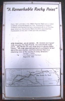
1. "A Remarkable Rocky Point" Marker
From 1821 until late in the 1800s Pawnee Rock was a noted landmark along the Santa Fe Trail. Thousands of wagons lumbered and creaked by here carrying goods to or from the great American Southwest. Many travelers recorded their impressions of this site in their journals and letters.
After Breakfast…we all started…. Mr. Gamble and myself rode out upon the high Prairie…to a remarkable rocky point…. [its] Rocks are very large and of a glossy Black colour…. We rode upon the top which is probably 50 feet above the plain below, and from whence there is a charming view of the country in every direction.”
George C. Sibley,
U. S. Government Surveyor
August 30, 1825
Erected by Kansas State Historical Society.
Topics and series. This historical marker is listed in these topic lists: Environment • Industry & Commerce • Roads & Vehicles. In addition, it is included in the Santa Fe Trail series list. A significant historical year for this entry is 1821.
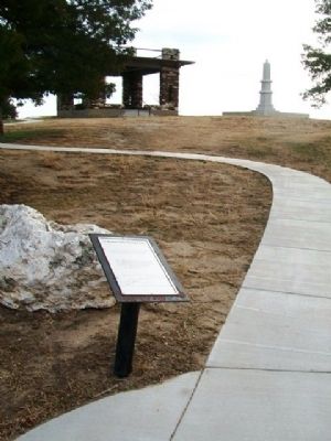
Location. 38° 16.345′ N, 98° 58.953′ W. Marker is in Pawnee Rock, Kansas, in Barton County. It is in Pawnee Rock Township. It can be reached from North Centre Street. Marker is at the beginning of the walking path to the top of Pawnee Rock, at Pawnee Rock State Historical Site, off SW 112th Avenue/Center Street. Touch for map. Marker is at or near this postal address: 631 N Centre St, Pawnee Rock KS 67567, United States of America. Touch for directions.

Regionally, this marker is in Central Kansas. It is also in the American Midwest, in the Corn Belt, on the prairies, on the Southern Plains, and on the Santa Fe Trail Corridor. Globally, it is in North America, the Western Hemisphere, the Western World, and the Anglosphere. Historically, it finds itself in what was once the Louisiana Purchase.
Other nearby markers. At least 8 other markers
this page online
Also see . . .
1. Pawnee Rock State Historical Site, Kansas. (Submitted on April 7, 2013, by William Fischer, Jr. of Reynoldsburg, Ohio.)
2. Santa Fe National Historic Trail. (Submitted on April 7, 2013, by William Fischer, Jr. of Reynoldsburg, Ohio.)
3. Santa Fe Trail Association. (Submitted on April 7, 2013, by William Fischer, Jr. of Reynoldsburg, Ohio.)
Photographed by William Fischer, Jr., November 9, 2012
2. "A Remarkable Rocky Point" Marker
Kansas State Historical Society, undated
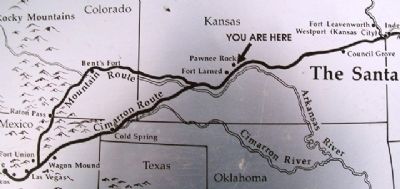
3. Map on "A Remarkable Rocky Point" Marker
Photographed by William Fischer, Jr., November 9, 2012
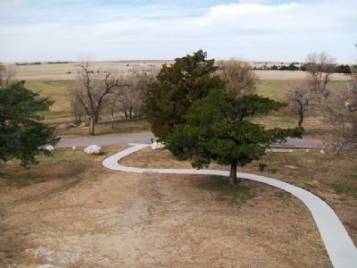
4. View of "A Remarkable Rocky Point" Marker
Credits. This page was last revised on June 16, 2016. It was originally submitted on April 7, 2013, by William Fischer, Jr. of Reynoldsburg, Ohio. This page has been viewed 658 times since then and 17 times this year. Photos: 1, 2, 3, 4. submitted on April 7, 2013, by William Fischer, Jr. of Reynoldsburg, Ohio.
