
Gladys in Campbell County, Virginia — The American South (Mid-Atlantic)
Shady Grove

1. Photo Wanted for this Marker
Erected 1997 by Department of Historic Resources. (Marker Number L-12.)
Topics and series. This historical marker is listed in these topic lists: Agriculture • Architecture • Cemeteries & Burial Sites • Settlements & Settlers. In addition, it is included in the Virginia Department of Historic Resources (DHR) series list. A significant historical year for this entry is 1825.
Location. Marker has been reported missing. It was located near 37° 9.915′ N, 79° 4.473′ W. Marker was in Gladys, Virginia, in Campbell County. It was on Brookneal Highway (U.S. 501) near Pigeon Run Road (County Route 652), on the right when traveling south. It was in Gladys, between the highway and the railroad tracks. Touch for map. Marker was in this post office area: Gladys VA 24554, United States of America. Touch for directions.

Regionally, this marker was in the Piedmont and in Central Virginia. It was also in the American South and specifically in the Upper South. Globally, it was in North America, the Western Hemisphere, the Western World, and the Anglosphere. Historically, it found itself in what was once the territory of the Mississippian Culture, one of the original Thirteen Colonies, one of the Confederate States
this page online
Other nearby markers. At least 8 other markers are within 11 miles of this location, measured as the crow flies: Campbell County Training School (approx. 7.7 miles away); Original Site of Campbell County Training-High School (approx. 7.8 miles away); Campbell County War Memorial (approx. 7.8 miles away); Old Rustburg (approx. 7.9 miles away); Col. Vincent W. “Squeek” Burnett (approx. 9.8 miles away); Hat Creek Church (approx. 10.6 miles away); Patrick Henry’s Grave (approx. 10.8 miles away); Birthplace of General Pick (approx. 10.9 miles away).
More about this marker. The 1941 fifth edition of the State Historical Markers of Virginia booklet is the first to list a marker with the same name but numbered R-12 at this location. Margaret Peter’s 1985 A Guidebook to Virginia’s Historical Markers book lists a marker numbered L-12 with the same name here. Both listings show the following text: “Two miles east is Shady Grove, built by Patrick Henry for his son, Spotswood Henry.” That text has been proven incorrect, hence the new marker listed in Scott Arnold’s 2007 guidebook, numbered
Photographed by J. J. Prats, March 30, 2013
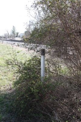
2. Missing Marker’s Post
Regarding Shady Grove. Shady Grove is on County Route 650, Mollies Creek Road, a right turn off Pigeon Run Road. It is private property.
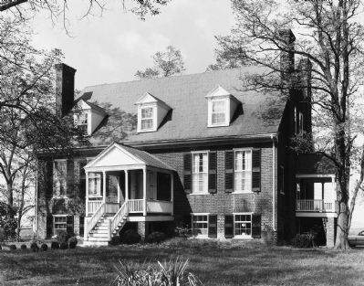
3. Shady Grove
Photo in the National Register of Historic Places nomination file.
Credits. This page was last revised on February 3, 2020. It was originally submitted on April 6, 2013, by J. J. Prats of Powell, Ohio. This page has been viewed 1,395 times since then and 61 times this year. Last updated on April 7, 2013, by Glenn Sheffield of Tampa, Florida. Photos: 1, 2, 3. submitted on April 6, 2013, by J. J. Prats of Powell, Ohio. • Bill Pfingsten was the editor who published this page.
