Turner's Creek Landing in Kent County, Maryland — The American Northeast (Mid-Atlantic)
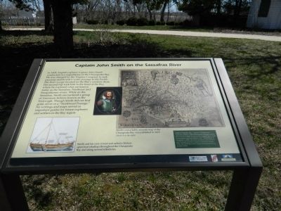
Captain John Smith on the Sassafras River
Inscription.
In 1608, English explorer Captain John Smith conducted two expeditions on the Chesapeake Bay. He was charged by the Virginia Company to seek precious metals and a water passage to the Pacific. His first voyage focused on the Bay's western shore. His second trip took him to the head of the Bay, where he explored what are known today as the Sassafras, Northeast and Susquehanna rivers. While on the Sassafras, Smith encountered a group of American Indians known as the Tockwogh. Though Smith did not find gold, silver or a "Northwest Passage," his writings and maps served as important guides for future explorers and settlers in the Bay region.
Inset
Smith and his crew rowed and sailed a 28-foot open boat (shallop) throughout the Chesapeake Bay and along several tributaries.
Map
Smith's remarkably accurate map of the Chesapeake Bay was published in 1612. (North is to the right)
Black Inset
Sultana Projects, Inc. - based in Chestertown - replicated Smith's 1608 Chesapeake voyages during the summer of 2007 to launch the Captain John Smith Chesapeake National Historic Trail. Established by Congress in 2005, the Trail commemorates Smith's epic voyages and their import in American history. Visit www.smithtrail.net or www.sultanaprojects.org to learn more.
Erected by Chesapeake Bay Gateways Network.
Topics and series. This historical marker is listed in these topic lists: Exploration • Native Americans • Waterways & Vessels. In addition, it is included in the Captain John Smith Chesapeake National Historic Trail series list. A significant historical year for this entry is 1608.
Location. 39° 21.268′ N, 75° 59.087′ W. Marker is in Turner's Creek Landing, Maryland, in Kent County. Marker can be reached from Turners Creek Road. Marker is on the grounds of Knock's Folly. Touch for map. Marker is in this post office area: Kennedyville MD 21645, United States of America. Touch for directions.
Other nearby markers. At least 8 other markers are within walking distance of this marker. The Tockwogh and the Bay (here, next to this marker); A Home with a Rich Past (a few steps from this marker); Natural Diversity at Turner's Creek (within shouting distance of this marker); Agricultural Demonstration Area / Historic Tree Grove (about 400 feet away, measured in a direct line); Welcome to the Kent Museum (approx. 0.2 miles away); Turner's Creek (approx. ¼ mile away); Waterfront Hub for Trade (approx. ¼ mile away); Corn Crib (approx. ¼ mile away). Touch for a list and map of all markers in Turner's Creek Landing.
Credits. This page was last revised on September 2, 2022. It was originally submitted on April 12, 2013, by Bill Pfingsten of Bel Air, Maryland. This page has been viewed 729 times since then and 33 times this year. Photo 1. submitted on April 12, 2013, by Bill Pfingsten of Bel Air, Maryland.
Editor’s want-list for this marker. A wide shot of the marker in context. • Can you help?
