Daviston in Tallapoosa County, Alabama — The American South (East South Central)
Horseshoe Bend Campaign Combatants
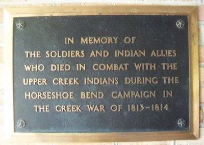
Soldiers and Indian allies
who died in combat with the
Upper Creek Indians during the
Horseshoe Bend Campaign in
the Creek War of 1813-1814
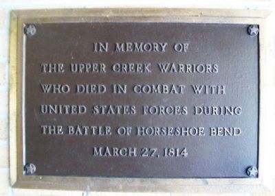
In memory of the
Upper Creek Warriors
who died in combat with
United States forces during
the Battle of Horseshoe Bend
March 27, 1814
Erected by National Park Service, U.S. Department of the Interior.
Topics. This memorial is listed in these topic lists: Native Americans • Patriots & Patriotism • Wars, US Indian.
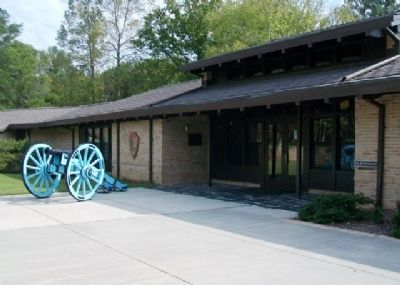
Location. 32° 58.94′ N, 85° 44.121′ W. Marker is in Daviston, Alabama, in Tallapoosa County. Markers are at the entrance to the park's Visitor Center. Touch for map. Marker is at or near this postal address: 11288 Horseshoe Bend Road, Daviston AL 36256, United States of America. Touch for directions.
Other nearby markers. At least 8 other markers are within walking distance of this marker. Horseshoe Bend National Military Park (about 800 feet away, measured in a direct line); A Bloody Contest (approx. 0.2 miles away); Futile Escape (approx. 0.4 miles away); Gun Hill (approx. 0.4 miles away); Horseshoe Bend Battleground Monument (approx. 0.4 miles away); Major Lemuel P. Montgomery (approx. half a mile away); Jackson Trace (approx. half a mile away); While the Long Roll Was Beating (approx. half a mile away). Touch for a list and map of all markers in Daviston.
Also see . . .
1. Horseshoe Bend National Military Park. (Submitted on April 20, 2013, by William Fischer, Jr. of Scranton, Pennsylvania.)
2. Creek War of 1813-14. Encyclopedia of Alabama entry. (Submitted on April 20, 2013, by William Fischer, Jr. of Scranton, Pennsylvania.)
3. Muscogee (Creek) Nation Official Site. (Submitted on April 21, 2013, by William Fischer, Jr. of Scranton, Pennsylvania.)
Credits. This page was last revised on September 20, 2020. It was originally submitted on April 20, 2013, by William Fischer, Jr. of Scranton, Pennsylvania. This page has been viewed 789 times since then and 23 times this year. Photos: 1, 2, 3. submitted on April 21, 2013, by William Fischer, Jr. of Scranton, Pennsylvania.


