Corregidor Island in Cavite, Calabarzon, Philippines — Southeast Asia
Spanish Historical Marker
Corregidor Island
Spanish:
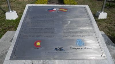
La isla de Corregidor pasó a formar parte de la Corona de España el 19 de Mayo de 1571, al ser ocupada por el intrépido navegante Miguel López de Legaspi, fundador de la Ciudad de Manila.
Debido a su posición estratégica, Corregidor sirvió como fortaleza protectora guardian de la Bahía de Manila durante 327 años, hasta el 2 de Mayo de 1898. Durante esos años presenció gloriosas escenas de heroism, en las que la historia de Filipinas y la de España se entrelazaron.
En conmemoración del Centenario de la Declaración de la Independencia de Filipinas, el Pueblo Español – a través de la Agencia Española de Cooperación Internacional – ofrece esta placa conmemorativa para que sean recordados tanta gloria y heroísmo, reflejados hoy en la estrecha amistad que une a España y a la República de Filipinas.
Corregidor Island became a part of the Spanish Crown on May the 19th, 1571, after its occupation by the dauntless navigator, Miguel López de Legaspi, who founded the City of Manila.
Due to its strategic position, Corregidor, which was a Spanish island for 327 years until May 2, 1898, served as a fortress, guarding Manila Bay. And as such, it witnessed a great deal of heroism in which the history of the Philippines and that of Spain were gloriously merged.
In commemoration of the Centennial of the Philippine Declaration of Independence, the people of Spain – through the Spanish Agency for International Cooperation – offers this marker to remind us of such glory and heroism, reflected today in the strong and binding friendship between Spain and the Republic of the Philippines.
Corporation logos:
Embajada de España
Corregidor Foundation, Inc.
Erected 1998 by Embassy of Spain.
Topics. This historical marker is listed in these topic lists: Colonial Era • Notable Events • Peace • War, Spanish-American. A significant historical year for this entry is 1571.
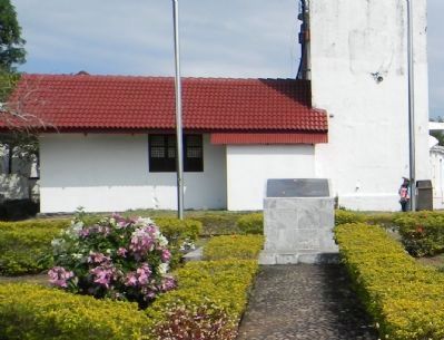
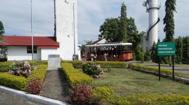
Location. 14° 22.706′ N, 120° 34.61′ E. Marker is on Corregidor Island, Calabarzon, in Cavite. Marker is on Topside Tour Trail close to Radar Tower. Touch for map. Touch for directions.
Other nearby markers. At least 8 other markers are within 3 kilometers of this marker, measured as the crow flies. Corregidor Lighthouse (about 90 meters away, measured in a direct line); 503rd Airborne- "The Rock Force" -Memorial (approx. 0.3 kilometers away); To the Angels (approx.
0.6 kilometers away); General Jonathan M. Wainwright Memorial (approx. 1.4 kilometers away); Corregidor (approx. 1.5 kilometers away); Malinta Tunnel (approx. 1.7 kilometers away); "For the Repose of Souls" (approx. 2.7 kilometers away); "Tribute to the Brave Heroes" (approx. 2.7 kilometers away). Touch for a list and map of all markers in Corregidor Island.
Also see . . . Philippine Declaration of Independence, 1898. (Submitted on April 26, 2013, by Richard E. Miller of Oxon Hill, Maryland.)
Credits. This page was last revised on February 12, 2022. It was originally submitted on April 25, 2013, by Richard E. Miller of Oxon Hill, Maryland. This page has been viewed 673 times since then and 15 times this year. Photos: 1, 2. submitted on April 25, 2013, by Richard E. Miller of Oxon Hill, Maryland. 3. submitted on April 26, 2013, by Richard E. Miller of Oxon Hill, Maryland. • Bill Pfingsten was the editor who published this page.


