Bath in Beaufort County, North Carolina — The American South (South Atlantic)
Colonial Bath
Photographed by Mike Stroud, April 19, 2013
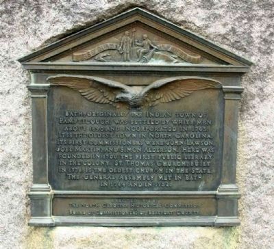
1. Colonial Bath Marker
Bath, originally the Indian town of Pampticough, was settled by white men about 1690 and incorporated in 1705. It is the oldest town in North Carolina. Its first commissioners were John Lawson, Joel Martin, and Simon Alderson. Here was founded in 1700 the first public library in the colony. St. Thomas' Church, built in 1734, is the oldest church in the state. The General Assembly met in Bath in 1744 and in 1752.
Erected 1918 by The North Carolina Historical Commission and Board of Commissioners of Beaufort County.
Topics. This historical marker is listed in these topic lists: Colonial Era • Education • Indigenous Peoples and Communities • Religion & Religious Structures • Settlements & Settlers. A significant historical year for this entry is 1690.
Location. 35° 28.662′ N, 76° 48.838′ W. Marker is in Bath, North Carolina, in Beaufort County. It is at the intersection of Carteret Street (County Road 99 / 92) and South Main Street, on the left on Carteret Street. Touch for map. Marker is in this post office area: Bath NC 27808, United States of America. Touch for directions.

Regionally, this marker
this page online
Other nearby markers. At least 8 other markers are within walking distance of this marker: Matthew Rowan (within shouting distance of this marker); Port of Bath and Thomas Harding (about 300 feet away, measured in a direct line); James Adams Floating Theatre (about 300 feet away); Palmer-Marsh House (about 300 feet away); First Public Library (about 400 feet away); a different marker also named Colonial Bath (about 600 feet away); Historic Bath (about 600 feet away); First Post Road (about 700 feet away). Touch for a list and map of all markers in Bath.
Also see . . . Beaufort-County - A Short History of Bath. In 1663 North Carolina was granted to eight
Photographed by Mike Stroud, April 19, 2013
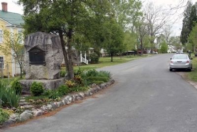
2. Colonial Bath Marker on South Main Street looking north
Photographed by Mike Stroud, April 19, 2013
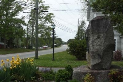
3. Colonial Bath Marker, looking west along Carteret Street (County Road 99 , 92 )
Credits. This page was last revised on October 4, 2024. It was originally submitted on April 26, 2013, by Mike Stroud of Bluffton, South Carolina. This page has been viewed 1,192 times since then and 48 times this year. Photos: 1, 2, 3. submitted on April 29, 2013, by Mike Stroud of Bluffton, South Carolina.
