Downtown in Hartford in Hartford County, Connecticut — The American Northeast (New England)
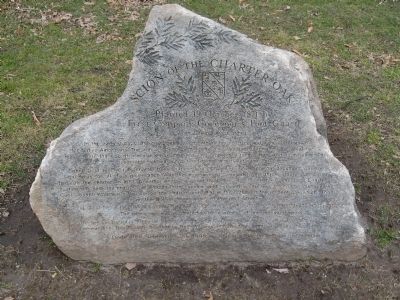
Scion of the Charter Oak
Planted 19 October 1871 by
First Company Governor's Foot Guard
White Oak (Quercus atba L)
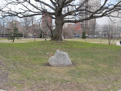
Connecticut received its charter from Charles II on October 9, 1662 and that document was the legal basis for all of its governance. With the accession of James II to the throne, there was a plan to seize the charter. In 1687 Governor Andros traveled to Hartford to collect the Connecticut Charter. A meeting was held, the charter was brought forth, candles went out and in darkness the charter disappeared. Capt. Joseph Wadsworth has seized the charter and hid it in the hollow of the ancient oak which stood on the Wyllys estate south of Prospect Street. The great tree blew down in a storm on August 21, 1856 at sundown that day. Bells tolled throughout Hartford. The tree's age was estimated to be in excess of one thousand years. This tree was planted in 1871 by the officers and men of the First Company Governor's Foot Guard, Major William H. Dodd commanding. This boulder donated by Bell, Williams, and Zito Monuments replaces the original marker.
Erected 1995.
Topics. This historical marker is listed in these topic lists: Colonial Era • Environment • Horticulture & Forestry. A significant historical date for this entry is September 23, 1865.
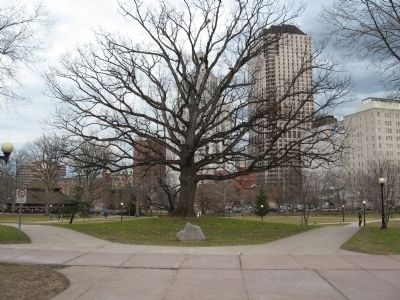
Location. 41° 45.829′ N, 72° 40.747′ W. Marker is in Hartford, Connecticut, in Hartford County. It is in Downtown. Marker is at the intersection of Elm Street and Clinton Street, on the left when traveling east on Elm Street. Located in Bushnell Park. Touch for map. Marker is in this post office area: Hartford CT 06106, United States of America. Touch for directions.
Other nearby markers. At least 8 other markers are within walking distance of this marker. Park History (a few steps from this marker); Chapman-Taft House (within shouting distance of this marker); Spanish War Veterans Memorial (within shouting distance of this marker); Spirit of Victory (about 300 feet away, measured in a direct line); a different marker also named Park History (about 500 feet away); a different marker also named Park History (about 500 feet away); Horace Wells (about 500 feet away); Horace Wells (about 500 feet away). Touch for a list and map of all markers in Hartford.
Regarding Scion of the Charter Oak. The Charter Oak is part of Connecticut’s history and lore. The tree, which grew in Hartford, was used in 1687 to hide the Connecticut Charter, issued by the King of England, to prevent its confiscation by the newly appointed governor. Seedlings from the large oak tree were planted in many places throughout Connecticut. Most have a small inconspicuous marker.
Also see . . . Charter Oak on Wikipedia. (Submitted on February 5, 2012, by Michael Herrick of Southbury, Connecticut.)
Credits. This page was last revised on August 9, 2023. It was originally submitted on February 5, 2012, by Michael Herrick of Southbury, Connecticut. This page has been viewed 1,743 times since then and 40 times this year. Last updated on May 1, 2013, by Wayne A. Donohue of West Harford, Ct.. Photos: 1, 2, 3. submitted on February 5, 2012, by Michael Herrick of Southbury, Connecticut.


