Fultonville in Montgomery County, New York — The American Northeast (Mid-Atlantic)
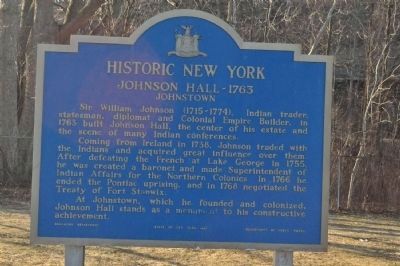
Johnson Hall - 1763
Historic New York
Coming from Ireland in 1738, Johnson traded with the Indians and acquired great influence over them. After defeating the French at Lake George in 1755, he was created a baronet and made Superintendent of Indian Affairs for the Northern Colonies. In 1766 he ended the Pontiac uprising, and in 1768 negotiated the Treaty of Fort Stanwix.
At Johnstown, which he founded and colonized, Johnson Hall stands as a monument to his constructive achievement.
Topics and series. This historical marker is listed in these topic lists: Colonial Era • Native Americans • Settlements & Settlers. In addition, it is included in the Historic New York State series list. A significant historical year for this entry is 1763.
Location. 42° 56.615′ N, 74° 23.646′ W. Marker is in Fultonville, New York, in Montgomery County. Marker is on Interstate 90. Marker is within a "Parking Area" and is partnered with the Mohawk Area marker. Touch for map. Marker is in this post office area: Fultonville NY 12072, United States of America. Touch for directions.
Other nearby markers. At least 8 other markers are within walking distance of this marker. Mohawk Area (within shouting distance of this marker); a different marker also named Mohawk Area (approx. 0.2 miles away); Herkimer Home - 1764 (approx. 0.2 miles away); Site of The Battle of Oriskany (approx. ¼ mile away); Veeder Home (approx. 0.3 miles away); A Liberty Pole (approx. half a mile away); Kateri's Home (approx. half a mile away); Liberty Pole (approx. half a mile away). Touch for a list and map of all markers in Fultonville.
Credits. This page was last revised on June 16, 2016. It was originally submitted on May 2, 2013, by Yugoboy of Rochester, New York. This page has been viewed 517 times since then and 17 times this year. Photos: 1, 2. submitted on May 2, 2013, by Yugoboy of Rochester, New York. • Bill Pfingsten was the editor who published this page.

