Near Megiddo, Haifa District, Israel — West Asia (the Levant in the Middle East)
A Public Grain Silo
Inscription.
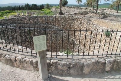
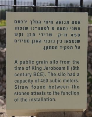
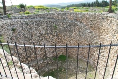
A public grain silo from the time of King Jeroboam II (8th century BCE). The silo had a capacity of 450 cubic meters. Straw found between the stones attests to the function of the installation.
Topics and series. This historical marker is listed in these topic lists: Agriculture • Anthropology & Archaeology • Settlements & Settlers. In addition, it is included in the Tel Megiddo series list.
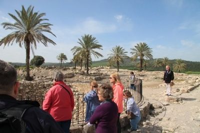
Location. 32° 35.093′ N, 35° 11.064′ E. Marker is near Megiddo, Haifa District. Marker can be reached from National Route 66 just north of National Route 65, on the left when traveling north. This historical marker is located in the Megiddo National Park. The park is located between the Megiddo and Yokne‘am junctions (road no. 66), about 2 km west of the Megiddo junction. The historical marker is situated at the top of Tel Megiddo, near the very center of the southern side of the archaeological park. Touch for map. Touch for directions.
Other nearby markers. At least 8 other markers are within walking distance of this marker. The Southern Palace (here, next to this marker); Schumaker's Excavations (within shouting distance of this marker); The Southern Stables (within shouting distance of this marker); The Water System (about 120 meters away, measured in a direct line); The Northern Palace (about 120 meters away); The Northern Stables (about 120 meters away); The Sacred Area (about 120 meters away); A Unique Continuity (about 120 meters away). Touch for a list and map of all markers in Megiddo.
More about this marker. The "Megiddo National Park" handout/brochure has this to say about Stop 15, the "Public Granary" on the historic tour:
The structure before you is a huge silo, 7 meters deep and 11 meters in diameter. Its walls are lined with field stones. Two staircases lead to the bottom, which was paved with pebbles. Kernels of wheat found between the stones along with the remains of straw identified the structure as a silo. Its volume was approximately 450 cubic meters, which meant it could store about 1,000 tons of wheat. The silo was built by one of the last Israelite kings, or perhaps during Assyrian rule. Some scholars believe the granary was built together with the stables to store fodder for the horses.
Related markers. Click here for a list of markers that are related to this marker. To better understand the relationship, study each marker in the order shown.
Also see . . .
1. Tel Megiddo
. This is a link to information provided by Wikipedia, the free encyclopedia. (Submitted on May 8, 2013, by Dale K. Benington of Toledo, Ohio.)
2. The Megiddo Expedition. This is a link to information provided by The Megiddo Expedition Website. (Submitted on May 8, 2013, by Dale K. Benington of Toledo, Ohio.)
3. Tell Megiddo. This is a link to information provided by the BibleWalks.com website. (Submitted on May 8, 2013, by Dale K. Benington of Toledo, Ohio.)
4. Jeroboam II. This is a link to information provided by Wikipedia, the free encyclopedia. (Submitted on May 9, 2013, by Dale K. Benington of Toledo, Ohio.)
5. Jeroboam II. This is a link to information provided by the Jewish Virtual Library (Submitted on May 9, 2013, by Dale K. Benington of Toledo, Ohio.)
Credits. This page was last revised on December 27, 2023. It was originally submitted on May 8, 2013, by Dale K. Benington of Toledo, Ohio. This page has been viewed 777 times since then and 39 times this year. Photos: 1, 2, 3, 4. submitted on May 8, 2013, by Dale K. Benington of Toledo, Ohio.


