Near Medicine Lodge in Barber County, Kansas — The American Midwest (Upper Plains)
Gypsum Hills Scenic Byway
Photographed by William Fischer, Jr., November 9, 2012
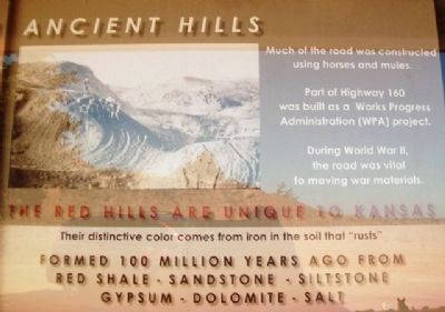
1. Gypsum Hills Scenic Byway Kiosk Historical Detail
along the Byway]
[Historical section follows]
Ancient Hills
The Red Hills are unique to Kansas
Their distinctive color comes from
iron in the soil that "rusts"
Formed 100 million years ago from
red shale - sandstone - siltstone
gypsum - dolomite - salt
Much of the road was constructed
using horses and mules.
Part of Highway 160 was built as a
Works Progress Administration (WPA) project.
During World War II, the road was
vital to moving war materials.
Erected by Gypsum Hills Scenic Byway and Kansas Department of Transportation.
Topics. This historical marker is listed in these topic lists: Environment • Industry & Commerce • Roads & Vehicles • War, World II.
Location. 37° 16.904′ N, 98° 44.94′ W. Marker is near Medicine Lodge, Kansas, in Barber County. It is on U.S. 160 0.6 miles west of Bitter Creek Road, on the right when traveling west. Marker kiosk is about nine miles west of Medicine Lodge. Touch for map. Marker is in this post office area: Medicine Lodge KS 67104, United States of America. Touch for directions.

Regionally,
this page online
Other nearby markers. At least 8 other markers are within 10 miles of this marker, measured as the crow flies: The Story of Prohibition (approx. 8.4 miles away); Medicine Lodge Treaty (approx. 8.4 miles away); Medicine Lodge and the Stockade (approx. 8.4 miles away); Veterans Memorial (approx. 8.9 miles away); Carry Nation Home (approx. 9.2 miles away); Medicine Lodge Stockade (approx. 9.3 miles away); a different marker also named Medicine Lodge Stockade (approx. 9.3 miles away); The First National Bank (approx. 9.3 miles away). Touch for a list and map of all markers in Medicine Lodge.
Also see . . .
1. Gypsum Hills Scenic Byway, Kansas. (Submitted on May 8, 2013, by William Fischer, Jr. of Reynoldsburg, Ohio.)
2. Gyp Hills Scenic Drive & Gypsum Hills Scenic Byway, Barber & Comanche counties.
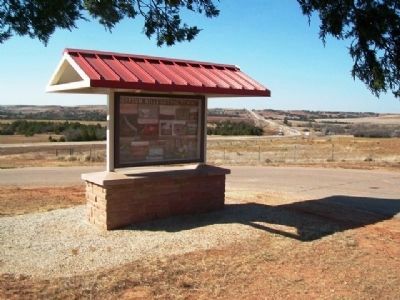
Photographed by William Fischer, Jr., November 9, 2012
2. Gypsum Hills Scenic Byway Kiosk
3. Red Hills (Kansas). Wikipedia entry (Submitted on December 20, 2020, by Larry Gertner of New York, New York.)
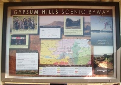
Photographed by William Fischer, Jr., November 9, 2012
3. Gypsum Hills Scenic Byway Kiosk (Side A)
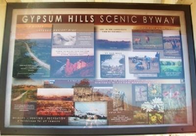
Photographed by William Fischer, Jr., November 9, 2012
4. Gypsum Hills Scenic Byway Kiosk (Side B)
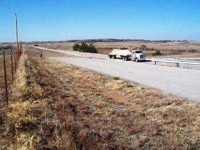
Photographed by William Fischer, Jr., November 9, 2012
5. Gypsum Hills Scenic Byway (US Hwy 160)
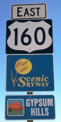
Photographed by William Fischer, Jr., November 9, 2012
6. Gypsum Hills Scenic Byway Road Sign
Credits. This page was last revised on December 20, 2020. It was originally submitted on May 8, 2013, by William Fischer, Jr. of Reynoldsburg, Ohio. This page has been viewed 1,052 times since then and 66 times this year. Photos: 1, 2, 3, 4, 5, 6. submitted on May 8, 2013, by William Fischer, Jr. of Reynoldsburg, Ohio.
