Hagerstown in Washington County, Maryland — The American Northeast (Mid-Atlantic)
Hagerstown
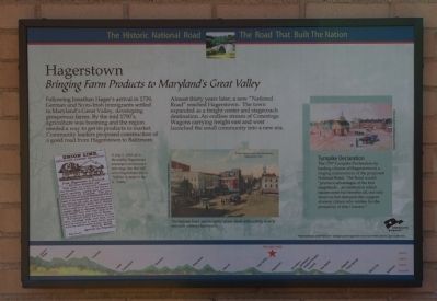
Bringing Farm Products to Maryland's Great Valley
— The Historic National Road - The Road That Built The Nation —
Inscription.
Following Jonathan Hager’s arrival in 1739, German and Scots-Irish immigrants settled in Maryland’s Great Valley, developing prosperous farms. By the mid 1790’s,
agriculture was booming and the region needed a way to get its products to market. Community leaders proposed construction of a good road from Hagerstown to Baltimore.
Almost thirty years later, a new “National Road” reached Hagerstown. The town expanded as a freight center and stagecoach destination. An endless stream of Conestoga Wagons carrying freight east and west launched the small community into a new era.
[sidebar]
Turnpike Declaration
The 1797 Turnpike Declaration by leading citizens of Hagerstown is a ringing endorsement of the proposed National Road. The Road would “produce advantages of the first magnitude…an institution which injures none but benefits all, not only deserves but demands the support of every citizen who wishes for the prosperity of this Country.”
Erected by America's Byways.
Topics and series. This historical marker is listed in these topic lists: Agriculture • Roads & Vehicles. In addition, it is included in the The Historic National Road series list. A significant historical year for this entry is 1739.
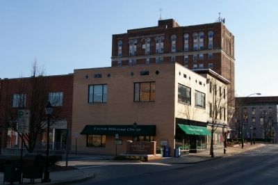
Location. 39° 38.545′ N, 77° 43.187′ W. Marker is in Hagerstown, Maryland, in Washington County. Marker is on North Potomac Street (Maryland Route 65), on the left when traveling south. Marker is located on the exterior of the Hagerstown Visitor's Center. Touch for map. Marker is at or near this postal address: 14 North Potomac Street, Hagerstown MD 21740, United States of America. Touch for directions.
Other nearby markers. At least 8 other markers are within walking distance of this marker. Gettysburg Campaign (here, next to this marker); Treatment of the Wounded (within shouting distance of this marker); First Battle of Hagerstown (within shouting distance of this marker); Second Battle of Hagerstown (within shouting distance of this marker); Hagerstown Ransomed (within shouting distance of this marker); A City Divided (within shouting distance of this marker); Hagerstown Commercial Core Historic District (within shouting distance of this marker); Ransom of Hagerstown (about 300 feet away, measured in a direct line). Touch for a list and map of all markers in Hagerstown.
Credits. This page was last revised on March 24, 2024. It was originally submitted on March 24, 2008, by Christopher Busta-Peck of Shaker Heights, Ohio. This page has been viewed 1,493 times since then and 19 times this year. Photos: 1, 2. submitted on March 24, 2008, by Christopher Busta-Peck of Shaker Heights, Ohio. 3. submitted on February 24, 2018, by William Fischer, Jr. of Scranton, Pennsylvania.


