Fort Dodge in Ford County, Kansas — The American Midwest (Upper Plains)
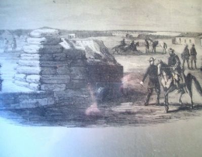
Storehouse
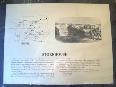
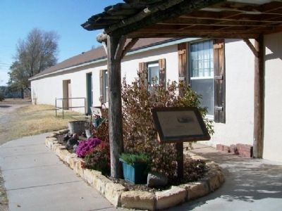
Twin storehouses, each 130 ft. by 30 ft., and a bakery were the first stone buildings to be completed in 1867. The second storehouse stood a few yards to the east. The north ends of each building were partitioned to provide offices for post headquarters and for the quartermaster. A bakery, located several yards behind, had two ovens, and was capable of baking 500 rations of bread each day. The frame structure, two doors to the right, was the original "dead house" and was moved from north of the hospital to its present location.
Major Henry Douglas, in command, and Lieutenant George A. Hesselberger, quartermaster, were severely reprimanded by General R. B. Marcy for reckless extravagance in constructing buildings grand enough "for the national capitol."
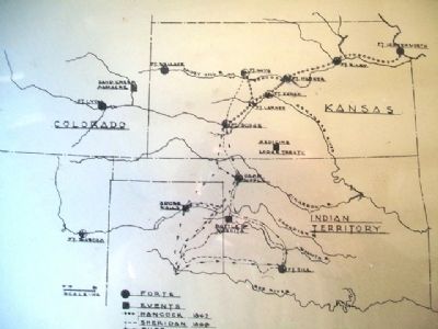
Fort Dodge was a pivotal fort during the Indian campaigns of 1868-69 and 1874-75. The Wet and Dry Routes of the Santa Fe Trail met here; the Fort Hays-Fort Dodge Trail ended here, and the Fort-Dodge-Fort Supply Trail began here. Millions of pounds of armaments and supplies were shipped south in trains of as many as 270 wagons.
Fort Dodge was considered the most important of all the forts along the Santa Fe Trail. It was in the heart of Indian country.
William Darnell,
Freighter, 1866
Topics. This historical marker is listed in these topic lists: Forts and Castles • Industry & Commerce • Roads & Vehicles • Wars, US Indian. A significant historical year for this entry is 1867.
Location. 37° 43.875′ N, 99° 56.248′ W. Marker is in Fort Dodge, Kansas, in Ford County. Marker is at the intersection of Pershing Street and Garfield Street, on the left when traveling west on Pershing Street. Marker is on the grounds of the Kansas Soldiers' Home. Touch for map. Marker is in this post office area: Fort Dodge KS 67843, United States of America. Touch for directions.
Other nearby markers. At least 8 other markers are within walking distance of this marker. Hospital (about 400 feet away, measured in a direct line); Enlisted Men's Barracks (about 500 feet away); Commanding Officer's Quarters (about 500 feet away); Fort Dodge (about 800 feet away); Sutler Store (approx. 0.2 miles away); Wagnor Memorial Fountain (approx. 0.2 miles away); a different marker also named Fort Dodge (approx. 0.2 miles away); Cemetery (approx. 0.3 miles away). Touch for a list and map of all markers in Fort Dodge.
Also see . . .
1. Fort Dodge. Kansas Cyclopedia (1912) entry (Submitted on May 19, 2013, by William Fischer, Jr. of Scranton, Pennsylvania.)
2. Fort Hays-Fort Dodge Trail, Kansas. Legends of America Website entry (Submitted on May 11, 2023, by Larry Gertner of New York, New York.)
3. Redoubts on the Fort Dodge-Camp Supply Trail. Oklahoma Historical Society website entry (Submitted on May 11, 2023, by Larry Gertner of New York, New York.)
4. Kansas Soldiers' Home, Fort Dodge. Kansas Commission on Veterans' Affairs Office website entry (Submitted on May 19, 2013, by William Fischer, Jr. of Scranton, Pennsylvania.)
Credits. This page was last revised on May 11, 2023. It was originally submitted on May 19, 2013, by William Fischer, Jr. of Scranton, Pennsylvania. This page has been viewed 365 times since then and 2 times this year. Photos: 1, 2, 3, 4, 5. submitted on May 19, 2013, by William Fischer, Jr. of Scranton, Pennsylvania.
