
Near Manassas in Prince William County, Virginia — The American South (Mid-Atlantic)
The Unfinished Railroad
Attacks on Jackson’s Line
| — | Second Battle of Manassas, Day Two, August 29, 1862 | — |
Photographed by J. J. Prats, June 10, 2006
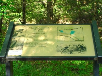
1. "The Unfinished Railroad" Marker
You are standing behind the Unfinished Railroad, Confederate General Stonewall Jackson’s main line of resistance. One the long afternoon of August 29, wave after wave of Federal regiments assaulted this position, their dead and wounded piling up on the forward slope of the embankment. For the Confederates, the worst moment came when Union Brig. Gen. Cuvier Grover’s troops broke through the line.
Topics and series. This historical marker is listed in these topic lists: Railroads & Streetcars • War, US Civil. In addition, it is included in the Manassas Gap Railroad series list.
Location. 38° 49.581′ N, 77° 32.89′ W. Marker is near Manassas, Virginia, in Prince William County. It can be reached from the intersection of Featherbed Lane (Groveton-Sudley Road) and General Trimbles Lane (a private road). Featherbed Lane runs from Lee Highway (U.S. Route 29) and Sudley Road (State Route 234). Marker is about
this page online

Regionally, this marker is in the Washington Metropolitan Area, in Northern Virginia, and in the Piedmont. It is also in the American South, specifically in the Upper South, in the Mid-Atlantic, and on the Eastern Seaboard. Globally, it is in the North Atlantic Region, North America, the Western Hemisphere, the Western World, and the Anglosphere. Historically, it finds itself in what was once the territory of the Mississippian Culture, one of the original Thirteen Colonies, one of the Confederate States of America, and the Antebellum South.
Other nearby markers. At least 5 other markers are within walking distance of this marker: Charge Bayonets! (within shouting distance of this marker); a different marker also named The Unfinished Railroad (about 300 feet away, measured in a direct line); Archer’s Brigade (about 300 feet away); Second Brigade (about 300 feet away); a different marker also named Unfinished Railroad (about 400 feet away). Touch for a list and map of

Photographed by J. J. Prats, June 10, 2006
2. Close Up of Map on Marker
Unfinished Railroad Loop Trail. The one mile trail follows the cuts and high banks of the historic railroad grade. An exhibit on the other side depicts Grover's bayonet charge from the Union perspective. On troop location makers, Union and Confederate soldiers describe the bloody ordeal in their own words.
More about this marker. There is a small parking lot at the trail head here.
Regarding The Unfinished Railroad. The “Unfinished Railroad” was the Independent Line of the Manassas Gap Railroad. The Independent Line was to run from Gainesville to Alexandria, allowing the railroad direct access to Alexandria, bypassing the interchange charges with the Orange and Alexandria Railroad at Manassas Junction. The line was graded and bridge abutments built, but rails were never laid.
Additional keywords. Gen. Philip Kearny
Photographed by J. J. Prats, June 10, 2006
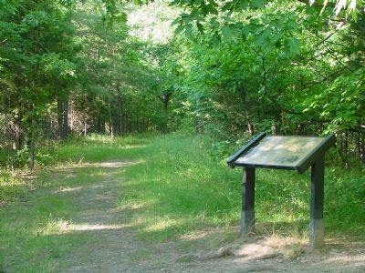
3. "The Unfinished Railroad" Marker
February 26, 2011
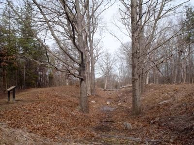
4. The Unfinished Railroad Marker
February 27, 2011
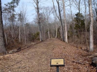
5. Unfinished Railroad Loop Trail
Typical view along the Unfinished Railroad Loop Trail - as seen here a few sections of the trail are along the top of the existing remains of the railroad bed.
Credits. This page was last revised on June 16, 2016. It was originally submitted on November 1, 2006, by J. J. Prats of Powell, Ohio. This page has been viewed 2,482 times since then and 30 times this year. Photos: 1, 2, 3. submitted on November 1, 2006, by J. J. Prats of Powell, Ohio. 4. submitted on February 26, 2011. 5. submitted on February 27, 2011.
